Skip to Content
Streetsblog Massachusetts home
Log In
Transit

Photos: A Construction Tour of Somerville’s Community Path and New Light Rail Line

12:27 PM EDT on September 12, 2022

People wearing day-glo vests walk along a paved path that's under construction, with bare soil and riprap on the ground to the left and the Green Line Extension tracks below them to the right.

Looking west from Walnut Street towards the Medford Street bridge, where the Community Path will provide access to the future Gilman Square Green Line station next to Somerville High School.

During last week’s NACTO conference in Boston, attendees streamed out of the Hynes Convention Center each morning for “walkshops” that offered tours of some of the region’s pedestrian, bike, and transit infrastructure.

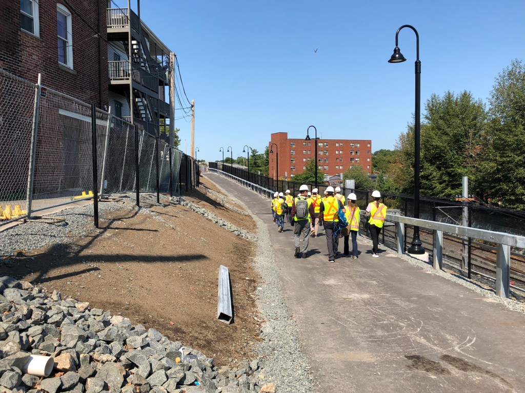
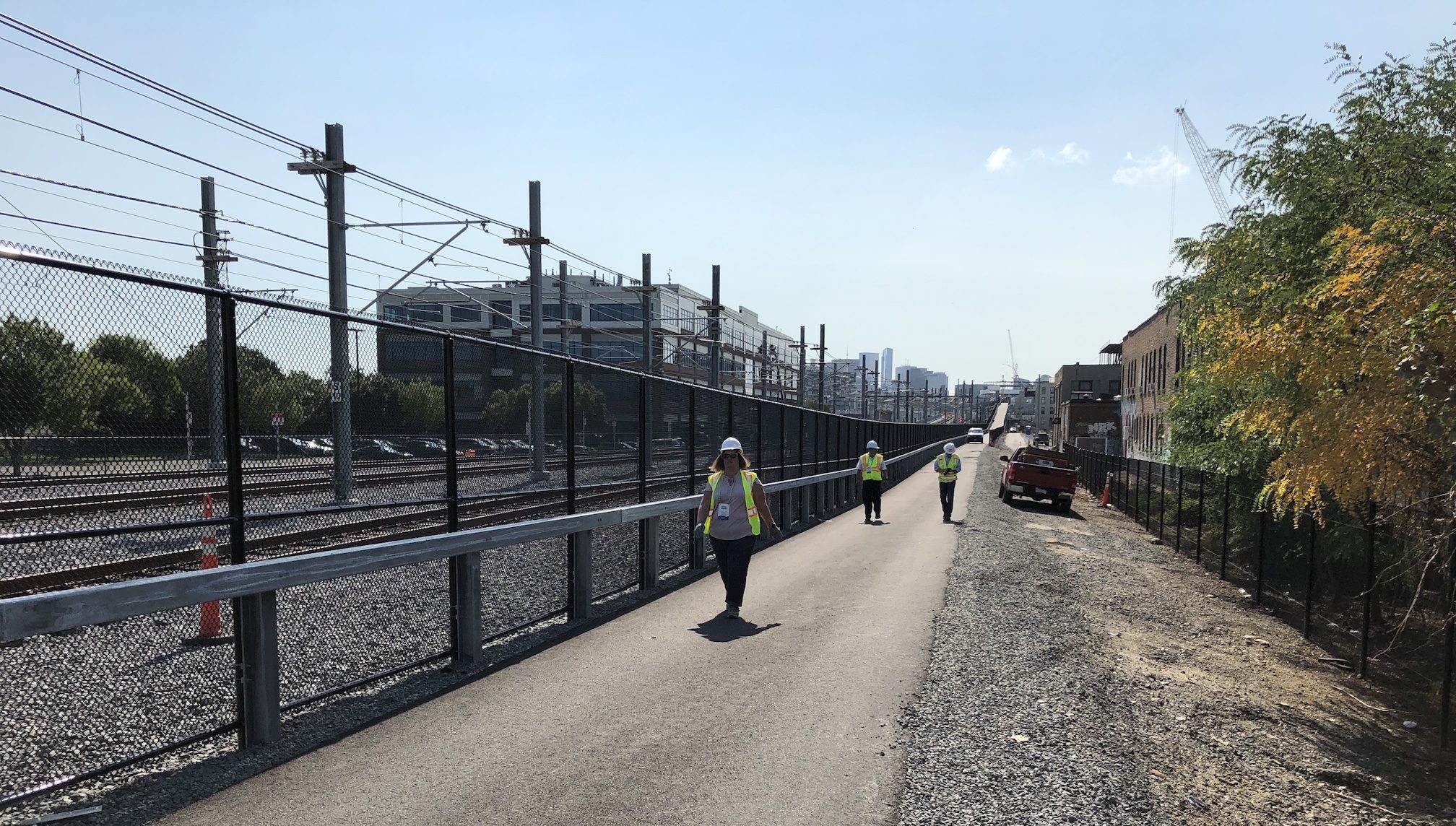
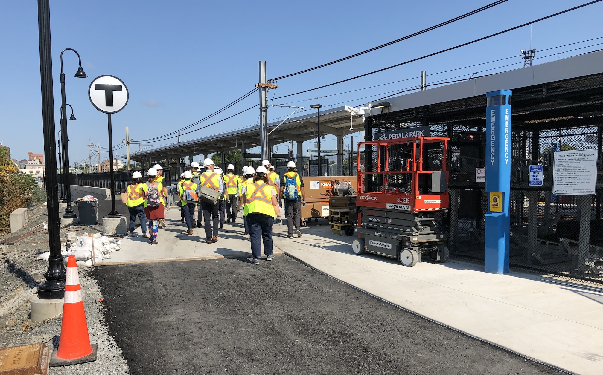
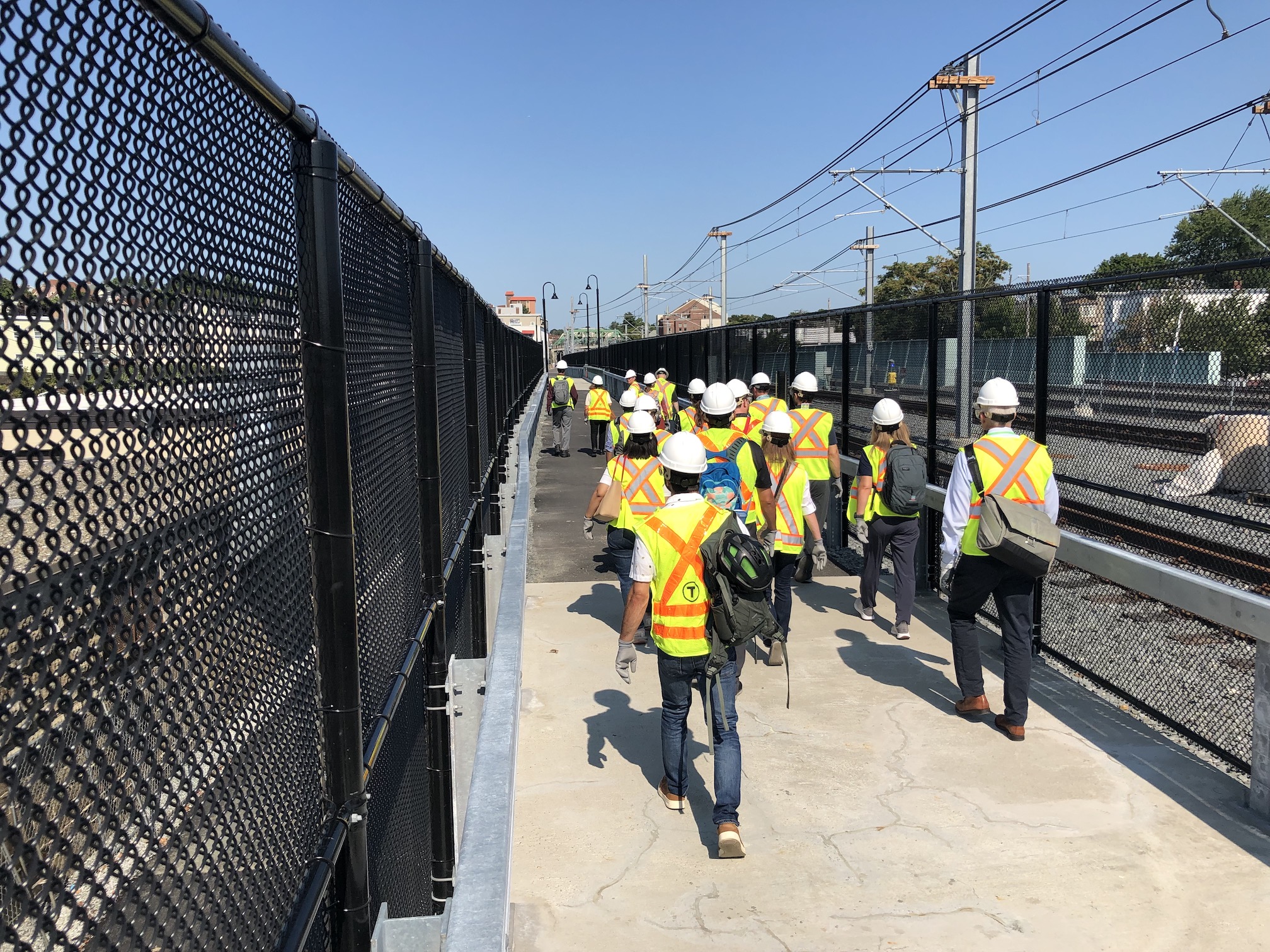
One of those walkshops offered a hard-hat construction tour of the Somerville Community Path Extension, which is nearing the end of its construction by the contractors in charge of the Green Line Extension project. Because the Community Path will offer a primary point of access to several stations along the Green Line’s new Medford branch, the path is expected to be open when the new light rail line opens to passengers later this year.

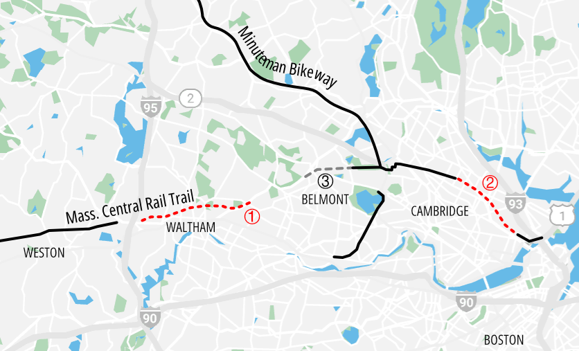
Our tour covered about 0.6 miles on the new path, from the Brickbottom neighborhood, just east of the future East Somerville Green Line station, to Medford Street, behind the new Somerville High School. But the full project will be a little over two miles long, and extend from the current terminus of the Community Path at Lowell Street to the Lechmere station across the city line in Cambridge:

A map of Mass. Central Rail Trail projects in the greater Boston region as of July 2022. Solid black lines indicate existing off-street paths in the Mass. Central Rail Trail network; dotted red lines indicate projects currently under construction: (1), the Waltham Wayside Trail project, and (2), the Somerville Community Path, being built as part of the Green Line Extension project. The dashed gray line marked (3) in Belmont is the first phase of the Belmont Community Path, which could go under construction in 2026.

Three people in construction vests walk down a long, straight paved pathway next to railroad tracks. In the distance the path ascends a ramp then curves out of sight, and beyond that is the skyline of downtown Boston.
Looking southeast from the East Somerville station towards downtown Boston. In the distance is the ramp that will carry the Community Path up and over the Green Line tracks into the Lechmere neighborhood, where the path will continue on existing pathways to the Charles River and downtown Boston.

People wearing construction vests pass under a "T" sign at the construction site for the East Somerville Green Line station. To the right is a bike parking pavilion, and in the distance is the canopy of the station's train platform. A row of lights on the left edge of the photo trace the course of a ramp that leads down to Washington Street.
For now, the Community Path will provide the primary station access point for the future East Somerville Green Line Station, pictured here. An access ramp visible at the left (behind the “T” sign) leads down to Washington Street. To the right is a bike parking area for Green Line riders who will access the new station by bike.

An overhead view of Washington Street, which features (from left to right) a new wide sidewalk, a protected bike lane, two motor vehicle lanes, and a red-painted bike-and-bus lane. In the middle distance is the McGrath Highway overpass. Beyond that are two high-rise buildings under construction at Union Square.
A view of Washington Street in East Somerville from the bridge that carries the Green Line Extension, Lowell Line commuter rail tracks, and the Community Path Extension. Pedestrians from East Somerville will access the new East Somerville station from a ramp leading up from Washington Street to the Community Path. The two new high-rise buildings are under construction on the skyline are next to the new Union Square Green Line stop, which opened earlier this year.

A crowd of people wearing bright construction vests and helmets crosses a bridge next to a chain-link fence (left) and railroad tracks (right)
A view of the new Community Path on the bridge that carries the Green Line Extension, Lowell Line commuter rail tracks, and the new trail over Washington Street in East Somerville.

A crowd of people wearing bright construction vests and helmets listens to a man wearing a backpack at the intersection of the Community Path, which runs alongside the railroad tracks, and a second path that leads uphill to street level, above the tracks. In the distance is the Cross Street bridge.
NACTO attendees hear from Derek Anderson, a consulting engineer for Arup, next to the access ramp that connects Cross Street (the bridge in the distance) to the Community Path.

A crowd of people in construction vests climbs a paved path as it gently climbs uphill next to a retaining wall (left) and a fence that separates the trail from the Green Line tracks (right)
West of the McGrath Highway, the Community Path begins to gently ascend from the track level up to the street level, to meet Walnut Street at-grade near the future Gilman Square Green Line Station.

Three woman wearing construction protective equipment stand in front of a chain-link fence
Karen Molloy (center), a longtime community advocate for the Community Path Extension, discusses the project’s history for NACTO conference attendees. Standing next to her is Viola Augustin (left), the City of Somerville’s liason to the Green Line Extension project.

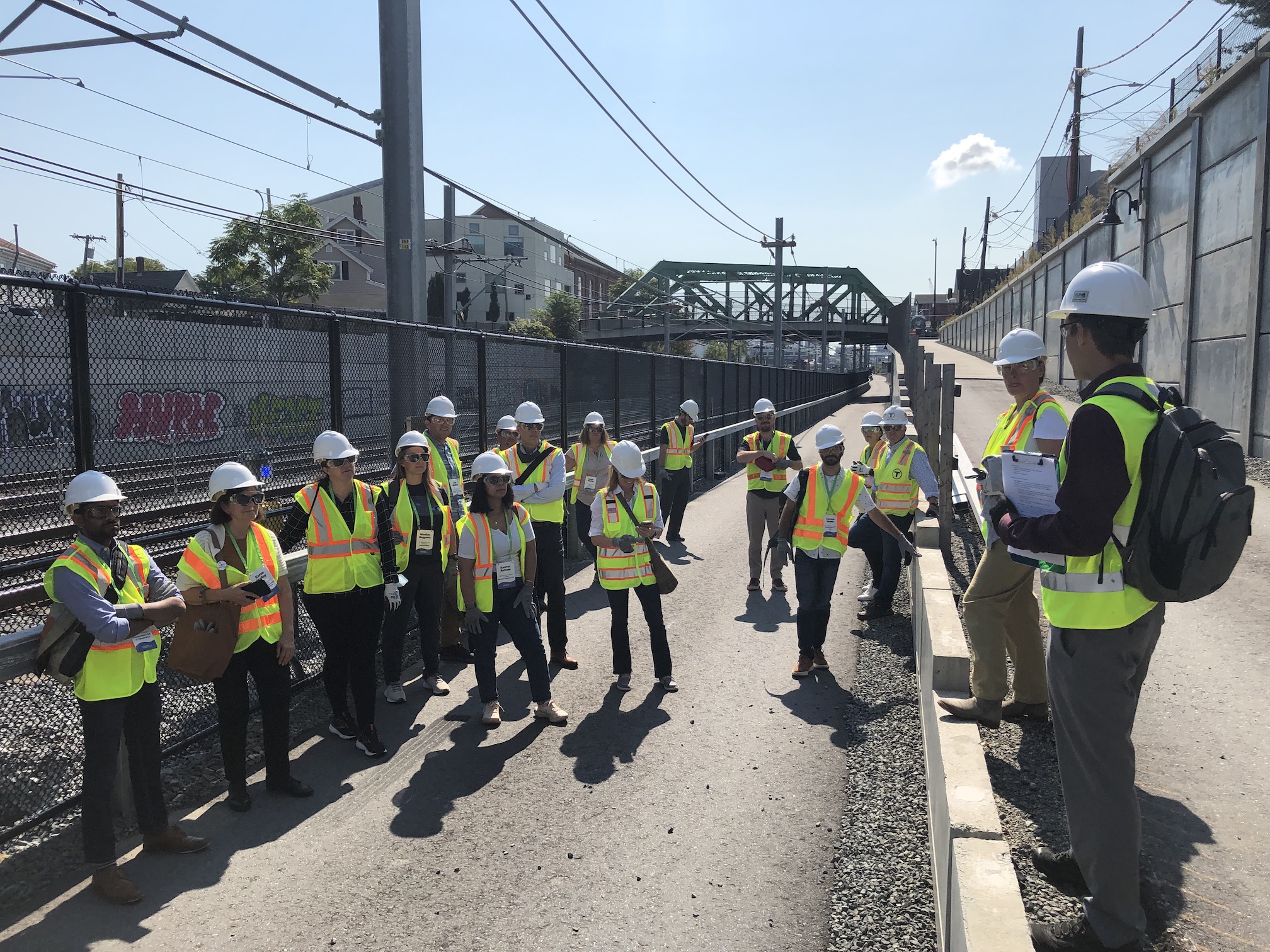
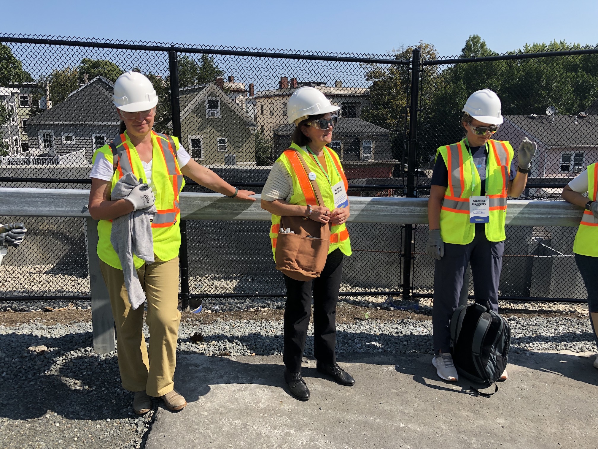
One of the walk’s guides was Karen Molloy, a leading figure in the Somerville Transportation Equity Partnership (STEP) who has been advocating for the Community Path Extension to be included as part of the Green Line Extension project for over a decade.

In 2015 and 2016, when Green Line Extension costs were spiraling out of control, the Community Path Extension was on the chopping block, but Molloy, local officials, and hundreds of other advocates lobbied to keep it in the scope of the project.

Last week’s tour was Molloy’s first time walking on the new path, and she said that it was an emotional experience to finally see the results of her advocacy firsthand.

“So many people worked so hard to make this happen,” said Molloy.

A newly-paved road, with a wide crosswalk in the foreground. A man on the sidewalk at left points at the striping on the left edge of the roadway. The paint of the roadway denotes two lanes for cars on the right, and a short segment of a narrower bikeway to the left, separated by a buffer area denoted by white hatch marks.
The new Medford Street Bridge (pictured) crosses the Green Line Extension at an angle, so it includes a short section of two-way cycletrack for bikes to get across safely. To the left is the entrance to the future Gilman Square Station.

However, the cost-cutting process did leave behind a few wished-for amenities.

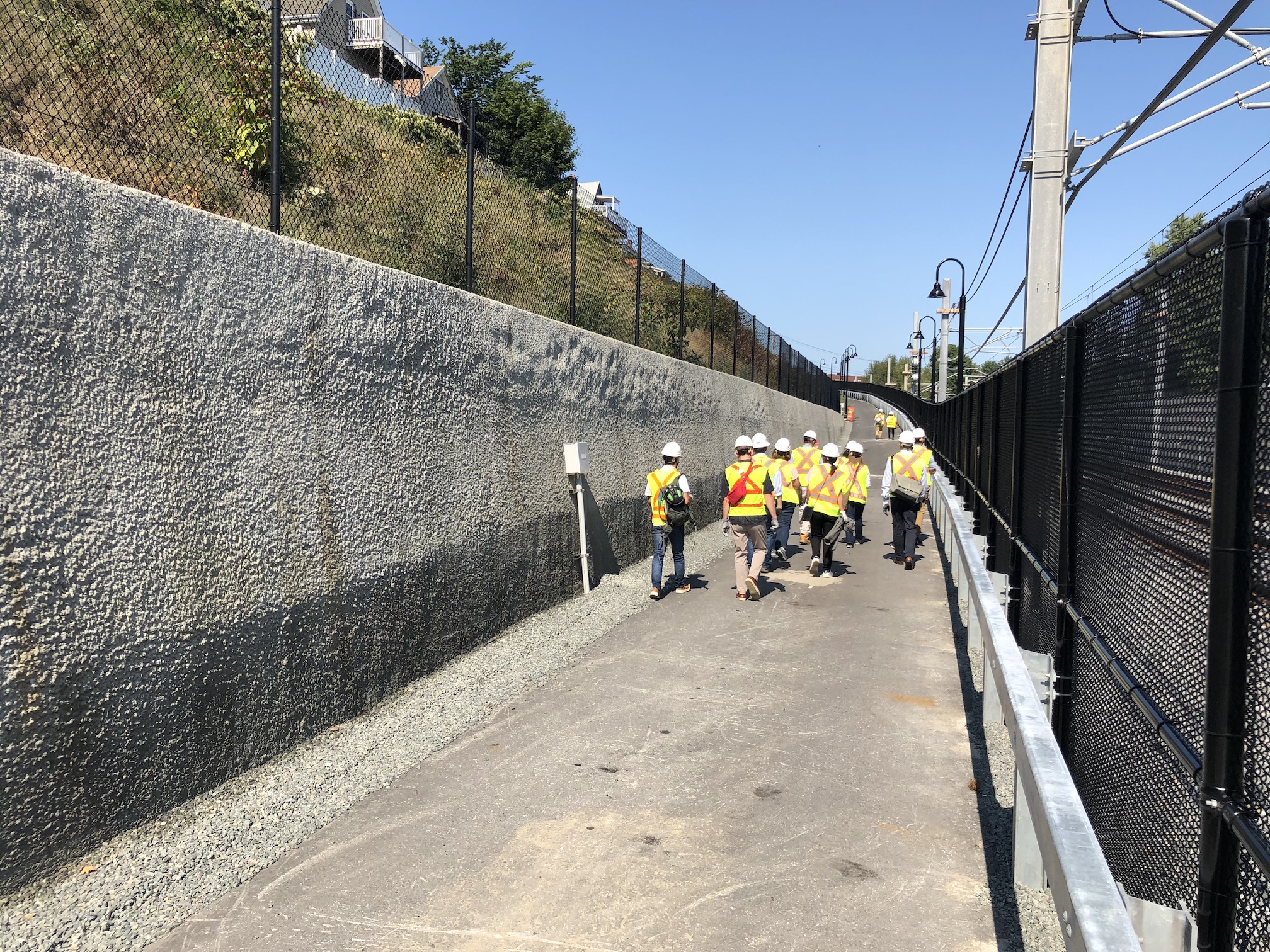
For instance, there will not be consistent sources of lighting along the path when in opens (you’ll see some street lamps along the path in some of the photos above, but not in others).

Viola Augustin, the City of Somerville’s liason to the Green Line Extension project, says that the city was able to negotiate the installation of electrical conduit along the entire path, and she is hopeful that the city will be able to install additional lighting after the Green Line project is officially complete.

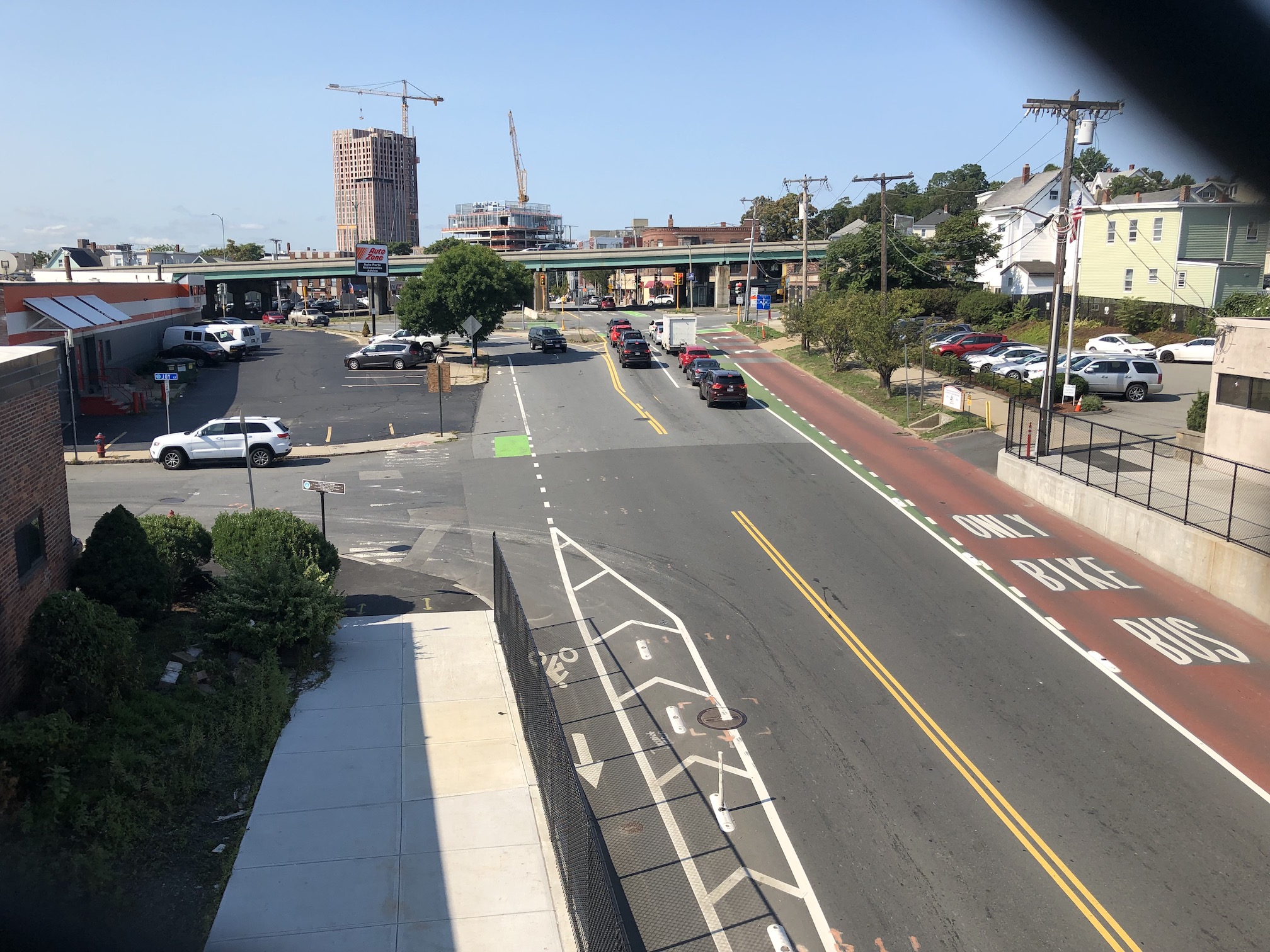
The other striking feature of the Community Path in its current form is the lack of any shade or greenery – a marked contrast to the existing Community Path west of Lowell Street.

Last week’s tour happened during a mild morning with temperatures around 70 degrees, but without any relief from the sun, it felt much warmer.

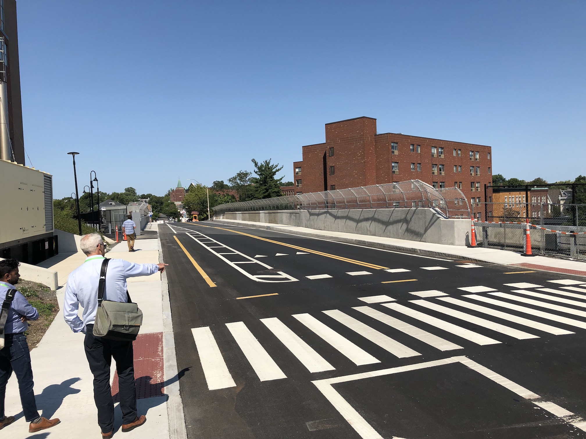
Project managers said that the MBTA is reluctant to allow trees anywhere near its tracks, where falling branches can wreak havoc with the overhead catenary wires that will deliver power to Green Line trains. But Augustin is hopeful that the T will allow smaller trees to be planted in locations where the risk of that happening would be low.

Somerville city officials are currently negotiating those details and many others in a long-term maintenance agreement for the new path with the MBTA, which will continue to own the land that the path is on after construction is completed.

Stay in touch

Sign up for our free newsletter