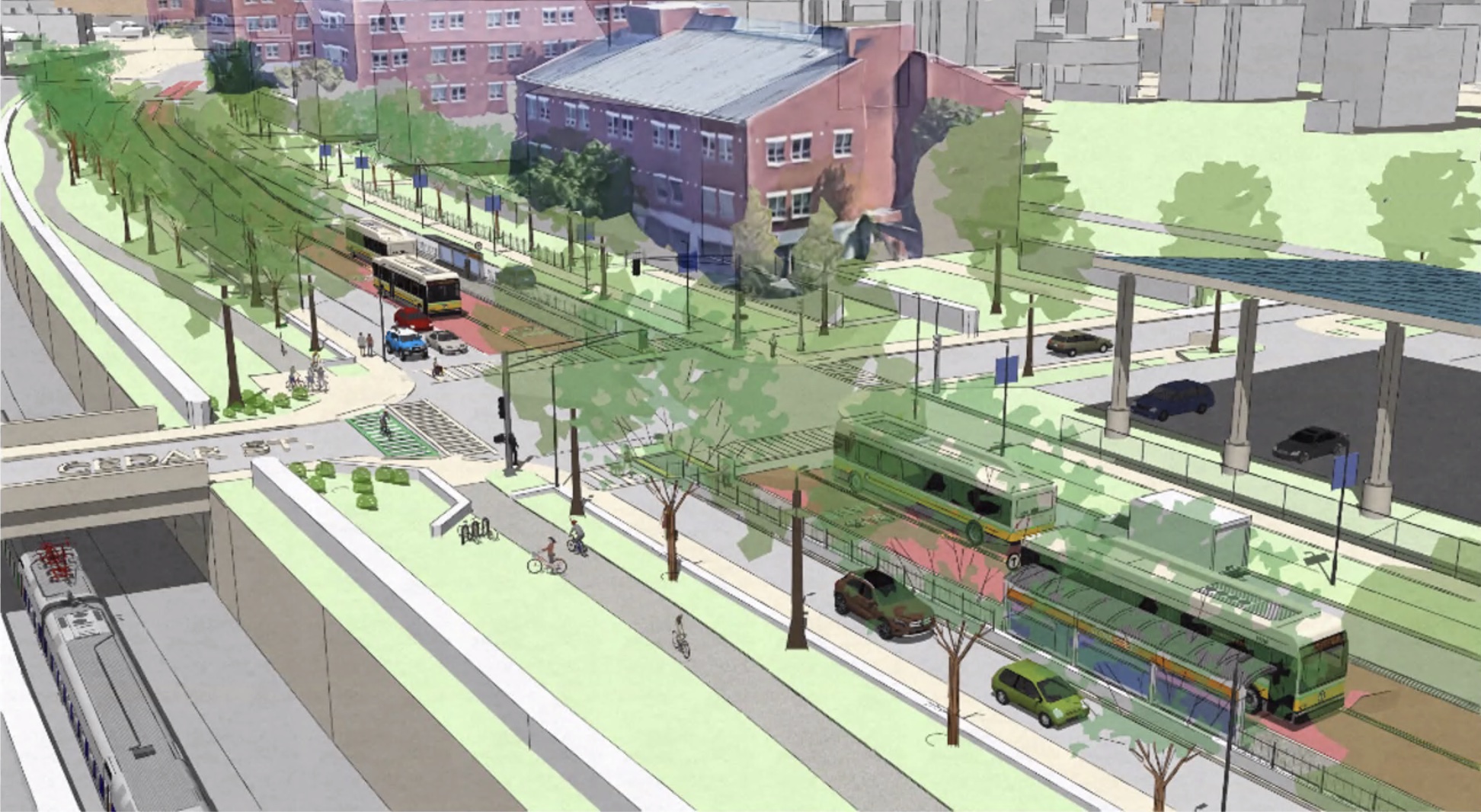

On Monday evening, planners from the MBTA and City of Boston presented early conceptual plans to build a mile's worth of new center-running bus lanes on Columbus Avenue and Tremont Streets, between the Jackson Square and Ruggles Orange Line stations.
The project's chief goals are to improve safety and support new, more frequent bus services that are being planned for the neighborhood as part of the MBTA's bus network redesign project.
The project would also upgrade the existing Southwest Corridor bike path and sidewalks with new, widened crossings at intersections, and increased green space to buffer the pathways from motor vehicle traffic on the adjacent roadway.
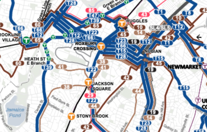
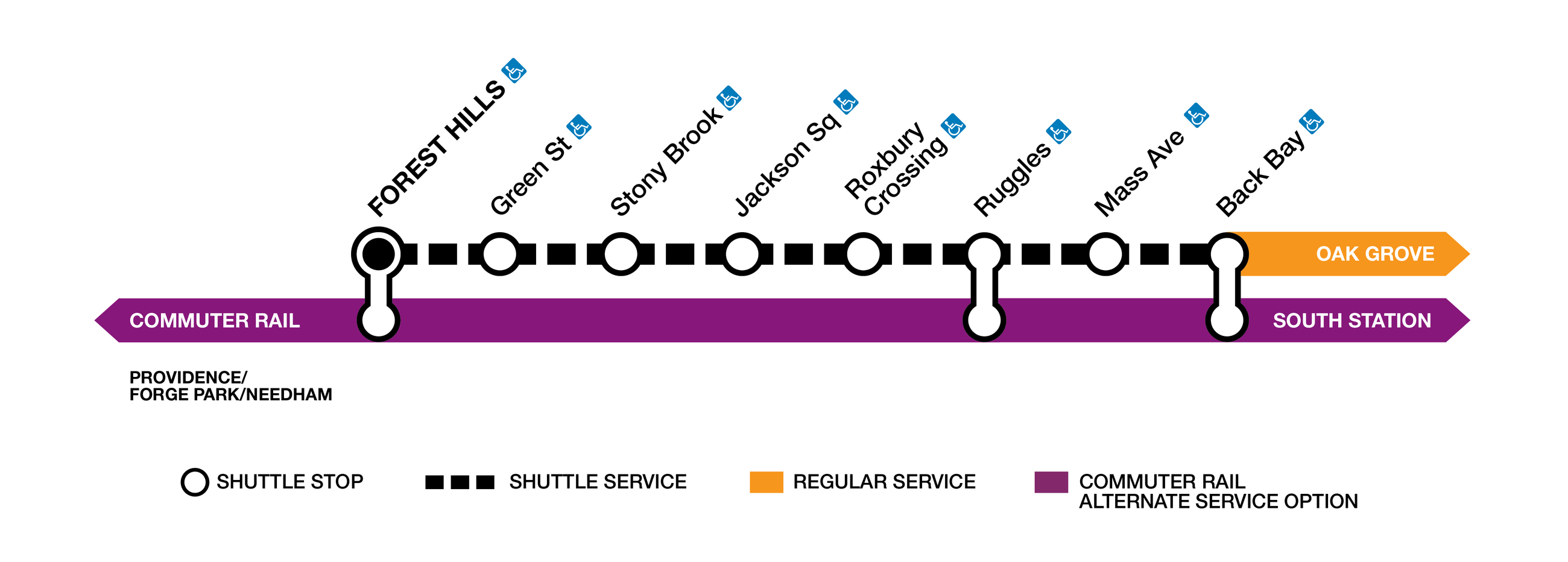
Under the T's planned new bus network, three of the MBTA's new "frequent-service" bus routes would benefit from the project's proposed bus lanes: the new 15 and 23 routes would use the new busway between Ruggles and Roxbury Crossing, where those routes would then turn east towards Nubian Square, and the new 22 route would use the busway between Franklin Park and Roxbury Crossing, before turning west to end in the Longwood Medical Area.
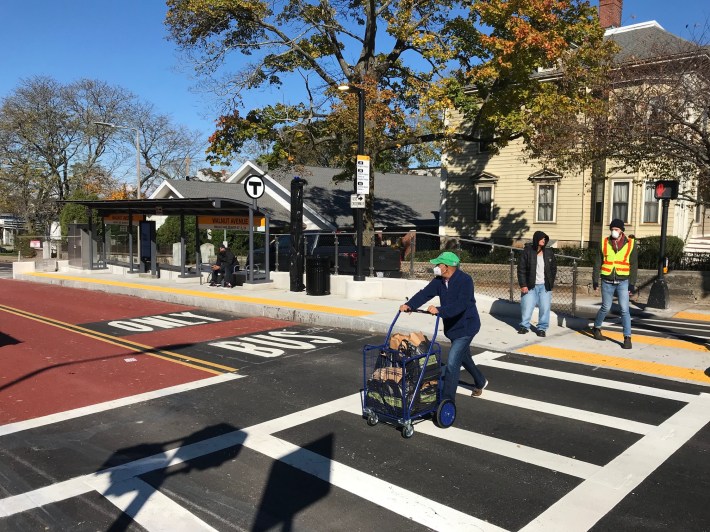
The project would more than double the length of the existing busway that opened on Columbus Avenue last year.
"If you look at the Columbus Ave. bus lanes that have been in operation since last fall, those bus lanes are saving peak-hour riders four to eight minutes per trip for only a 0.7-mile section of roadway," MBTA project manager Phillip Cherry told participants at Monday's virtual meeting.
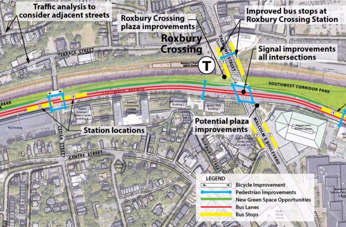
The project is also proposing larger bus stops and new mid-block crosswalks outside the Roxbury Crossing T station, which will become a major hub for bus traffic under the bus network redesign.
"Once the bus network redesign is implemented, it's likely that there will be 50 to 60 buses per hour in this area (at the intersection of Malcolm X, Tremont, and Columbus)," said Cherry.
In its current form, Columbus Avenue, which turns into Tremont Street north of Roxbury Crossing, is a six-lane-wide arterial where reckless speeding is common. The city has recorded 140 crashes along the corridor in the past four years, and city traffic studies have found that speeding over 50 miles per hour – more than double the speed limit – is common at all hours of the day.
The city and MBTA view the proposed bus lanes as complementary to efforts to improve safety. By restricting motor vehicle traffic to fewer lanes along the roadway, reckless drivers will have less space to attain dangerous speeds.
New bus platforms located in the middle of the roadway, between the center-running bus lanes and narrowed general-purpose lanes along the curb, would also effectively provide two safe refuges for pedestrians who are crossing the wide street:
Other safety upgrades being proposed include:
- New, upgraded pedestrian crossings at existing traffic lights along the corridor, plus new mid-block crosswalks on Tremont and Columbus to provide more direct access to the Roxbury Crossing Orange Line station
- Improved bicycle crossings at cross-streets along the Southwest Corridor trail, so that bikes will no longer have to share narrow curb ramps with pedestrians at intersections
- Repurposing some of Columbus Avenue's asphalt to create new "green infrastructure" that would narrow the roadway, calm traffic, and provide an additional buffer between the Southwest Corridor and motor vehicle traffic.
Project planners from the MBTA and City of Boston stressed that the plans that they presented during Monday's meeting were only an early concept, and that the city would be open to feedback.
"These are conceptual at this point and they will require a lot of tweaks, but we wanted to give you a sense of what the street could look like," said Boston Transportation Department transit planner Matt Moran.
Additional design work will continue over the coming year.