More Details On MassDOT’s Plans to Rebuild Bowker Overpass
MassDOT is moving ahead with plans to replace a crumbling segment of the notorious Bowker Overpass near Kenmore Square with a pair of new bridges.
The project will do little to reduce the highway’s footprint in the Emerald Necklace, but it will add a high-quality bike and pedestrian link over Interstate 90 to connect the Fenway to the Commonwealth Avenue mall.
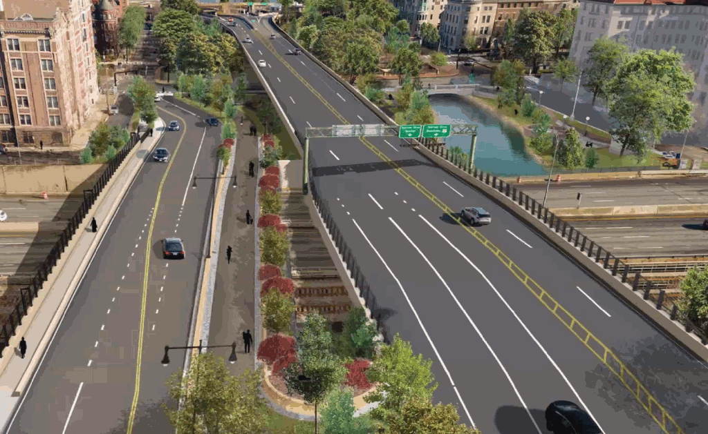
At a virtual project hearing on Thursday evening, MassDOT project manager Alwin Ramirez explained that the southern part of the Bowker Overpass – the segment that spans the Massachusetts Turnpike – is “deteriorating and in need of replacement,” with crumbling concrete on its superstructure and a patchwork of repairs visible on the roadway deck.
The $90 million project is on schedule to begin construction in 2025, and would be complete by 2028.
Bowker Viaduct will continue to overshadow Charlesgate Park
As we’ve previously reported here, MassDOT’s project assumes that the Bowker Viaduct, which hulks over the City of Boston’s historic Charlesgate parkland, will remain in place for decades to come.
MassDOT has shown a willingness to tear down other 1960s-era highway viaducts in other projects over the past decade, such as its 2015 demolition of the Casey Overpass in Jamaica Plain and its planned teardown and road diet for the McGrath Highway.
A 2015 analysis by Northeastern University engineers concluded that the Bowker Overpass could be torn down altogether, with no significant impact to drivers’ delays, by re-routing overpass traffic onto the Charlesgate East and Charlesgate West surface streets.
But in spite of increasingly forceful warnings that the agency needs to do more to address the climate emergency, MassDOT is not planning to take that approach here.
“The majority of the Bowker Overpass structure will remain in place with minimal repairs,” a MassDOT spokesperson told StreetsblogMASS last year. “This structure had significant repairs to the deck about 10 years ago.”
Plan would demolish one off-ramp, add second bridge
Instead, MassDOT’s plans call for the construction of a second bridge, parallel to the Bowker Overpass. This new bridge would connect Commonwealth Avenue to a new four-way intersection with Boylston Street south of the Turnpike.
By accommodating a new two-way connection to Commonwealth Avenue, the new bridge will also enable the demolition of an off-ramp to Commonwealth Ave. on the east side of the overpass (on the right side of the image above), which would in turn expose a block-long segment of the Muddy River to the daylight once again.
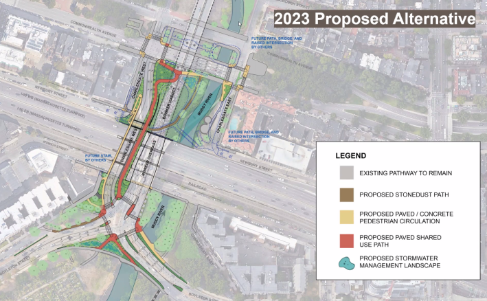
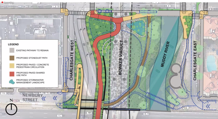
The new bridge will also include a major piece of bike and pedestrian infrastructure: a new multi-use path over the Turnpike that would connect the Back Bay Fens to the Commonwealth Avenue mall.
The multi-use path would include “a strip of landscape planting to continue the feeling of being in the Emerald Necklace,” according to project architect Dan Adams.
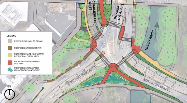
South of the Turnpike, the existing three-way intersection where the overpass traffic meets Boylston Street would become a four-way intersection in approximately the same footprint, where the two new bridges will meet. The new design would add more crosswalks, and, on the southern side of the intersection, additional green space and a widened multi-use pathway would replace the broad slip lane that currently carries eastbound Boylston Street traffic towards Back Bay:
The City of Boston’s Transportation Department recently installed a new protected bike lane through the Fenway neighborhood just one block away from this intersection, but the state’s Department of Conservation and Recreation controls this particular section of Boylston Street, and that agency has no public plans to resolve the gap in safe bicycle infrastructure through the Back Bay Fens.
MassDOT would also install a full complement of crosswalks where Commonwealth Avenue meets the Charlesgate streets, and where Boylston meets the overpass.
New landscaping in the neglected parkland would be designed to absorb polluted runoff from the highway viaduct.
A second planned project to reconfigure the highway ramps between the Bowker and Storrow Drive north of Beacon Street is expected to start the design process this winter, with construction scheduled to begin in 2027.

Read More:
Streetsblog has migrated to a new comment system. New commenters can register directly in the comments section of any article. Returning commenters: your previous comments and display name have been preserved, but you'll need to reclaim your account by clicking "Forgot your password?" on the sign-in form, entering your email, and following the verification link to set a new password — this is required because passwords could not be carried over during the migration. For questions, contact tips@streetsblog.org.