In Springfield, a city that ranks among the Commonwealth's most dangerous places for traffic violence, the intersection known as "The X" has a special distinction for the volumes of blood that drivers have spilled on its asphalt.
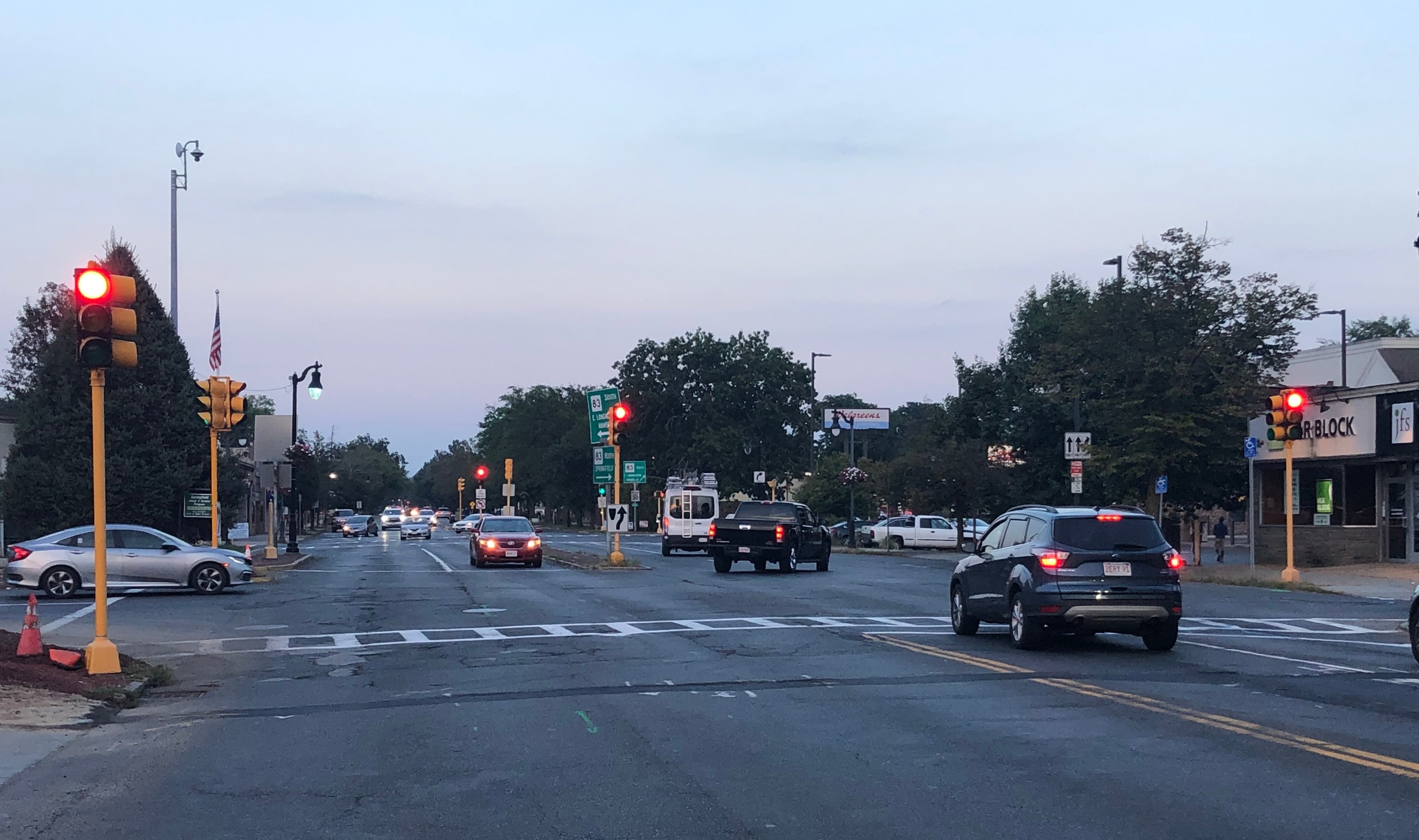
The X is where Sumner Avenue, a busy four-lane highway that divides the Forest Park neighborhood, meets two other busy streets, Belmont and Dickinson, in a huge junction that resembles a skewed asterisk (see it on on a map here).
The Pioneer Valley Planning Commission ranks it as the most dangerous intersection in the entire Connecticut River Valley. MassDOT's crash database lists 162 crashes in the vicinity of the X since the beginning of 2018, including 68 people injured in those crashes.
Later this year, the City of Springfield and MassDOT will spend $19 million – mostly from federal highway funding – to reconstruct the X intersection and install new traffic signals.
But in spite of the massive safety problems in the intersection, the engineers in charge of the project's design have sought exemptions from state safety standards in order to preserve the intersection's dangerous multi-lane layout.
Residents' safety takes a back seat to 'traffic flow'
The city's current plans would reroute each segment of Belmont Avenue on either side of the X to meet Sumner Avenue at new right-angled intersections, away from the main intersection of Sumner and Dickinson.
The proposal would narrow the two blocks of Belmont Avenue closest to the X to allow only a single lane of one-way motorized traffic leading away from Sumner Avenue in each direction.
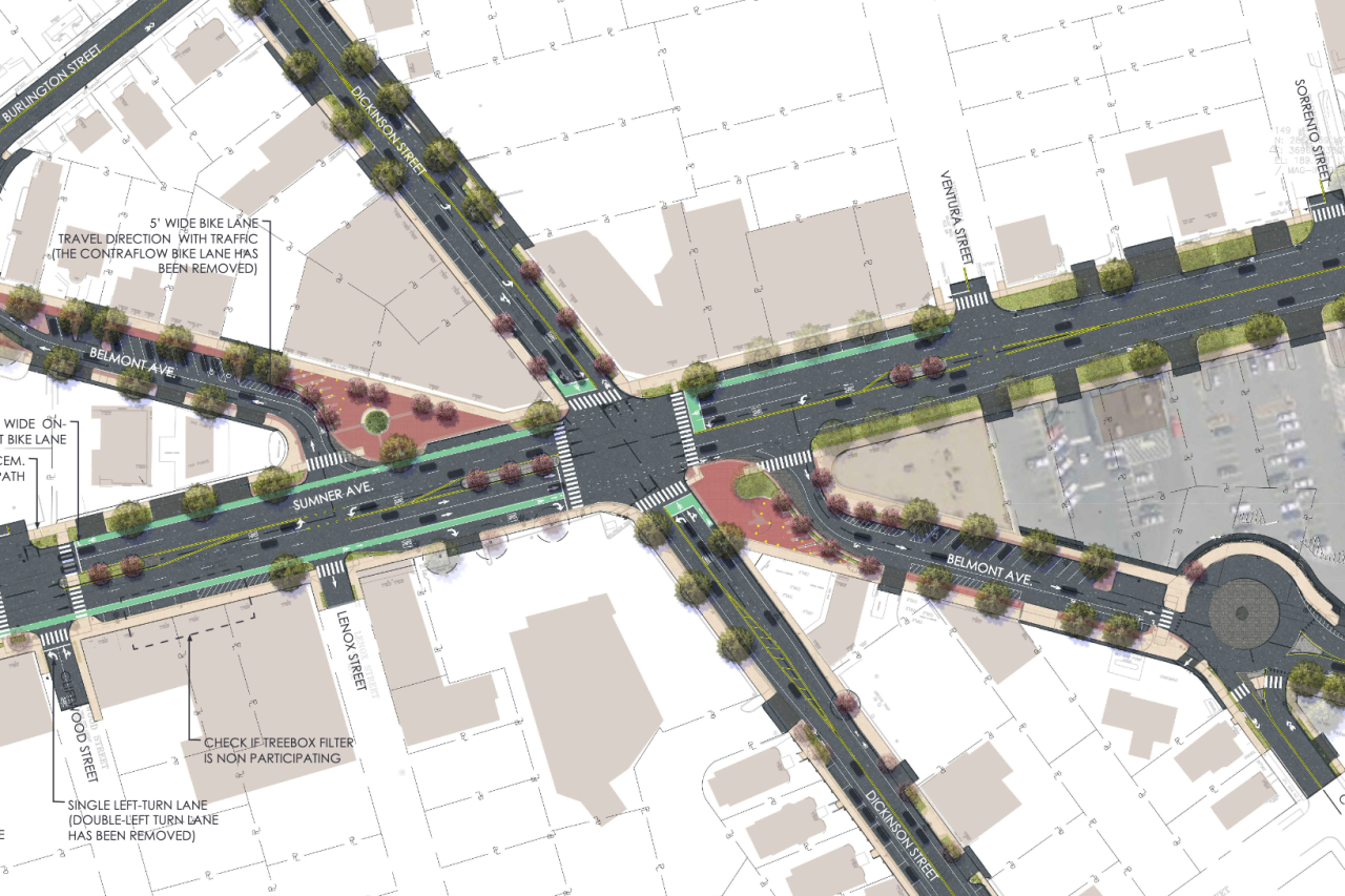
With these changes, it will no longer be possible to drive through the X on Belmont Avenue; car traffic using Belmont will have to re-route onto Dickinson, or other neighborhood streets, to cross Sumner Avenue.
Judging from the experience of similar projects elsewhere in the state, the narrowing of Belmont Avenue could significantly reduce the frequency of crashes on that particular street.
But there are roughly twice as many injury-causing crashes on the four-lane Sumner Avenue than on Belmont Avenue. And the plans for Sumner Avenue are considerably less ambitious.
Sumner Avenue has a 100-foot right-of-way, but the project's designers have chosen to dedicate the vast majority of its public space to the street's most dangerous users, with five lanes for motor vehicle traffic.
MassDOT and the City of Springfield are actually proposing to make Sumner Avenue's roadway even wider on several blocks to accommodate a center-turn lane and new on-street parking areas.
The proposed design might make it seem as though the project's designers aren't making safety the top priority for the $19 million project – and Springfield's top Public Works official has admitted as much.
“The general purpose is, number one, to get traffic to flow better,” Chris Cignoli, the Springfield Department of Public Works superintendent, said at a public hearing on the intersection plans last summer.
Project designers rejected MassDOT safe streets design requirements
The proposed accommodations for bicycle riders on Sumner Avenue are especially paltry, with a paint-only bike lane that will disappear after 2 to 3 blocks in either direction.
That design contradicts MassDOT's "controlling criteria" for roadway projects, which require "a shared-use path, side path, separated bicycle lane, or
buffered bicycle lane" on construction projects that affect multi-lane streets like Sumner Avenue.
But instead of honoring that requirement, the City of Springfield and its design consultants, Fuss & O'Neill, sought permission to ignore MassDOT's safe streets design requirements for one of the Commonwealth's most dangerous intersections.
In an email to StreetsblogMASS, Alex Maxwell, an employee with Fuss & O'Neill, wrote that "design exceptions were approved for the current plans in 2021."
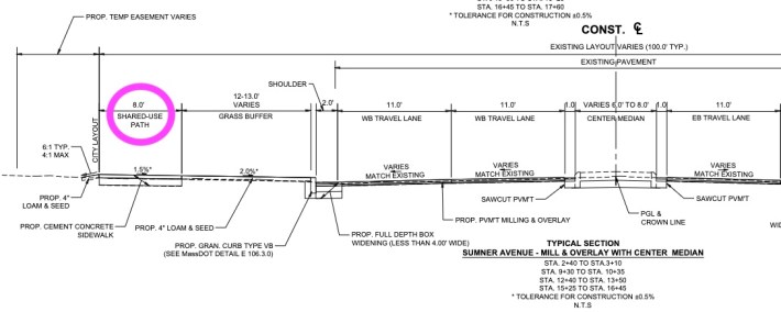
Maxwell added that "the current plans provide separated shared use paths while maintaining the vehicle lanes."
But a closer look at those "separated shared use paths" in project plans reveals that they are little more than a rebranded version of existing sidewalks on Sumner Avenue.
And while MassDOT's engineering standards specify that shared-use pathways should be 10 feet wide at minimum so that bike riders and pedestrians can safely pass each other, the proposed "paths" on Sumner Avenue will only be 8 feet wide.
