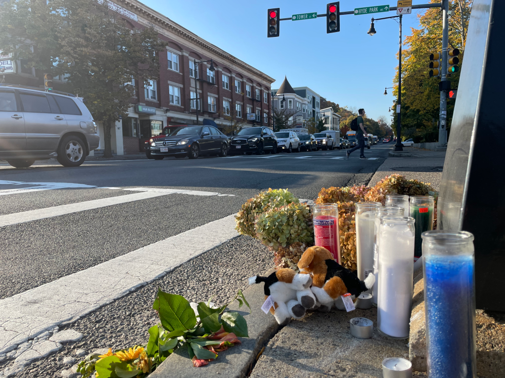
Driver Kills Pedestrian On Route 1A In East Boston
On Saturday afternoon, a driver struck and killed a pedestrian on Route 1A (also known as the McClellan Highway) near Curtis Street in East Boston.
A Boston Police spokesperson identified the victim as Ernest Partin, aged 38.
Police initially responded to a 911 call reporting a crash in the vicinity of McClellan and Addison Street around 5:21 p.m. on Saturday afternoon.
Emergency workers declared Partin dead on the scene.
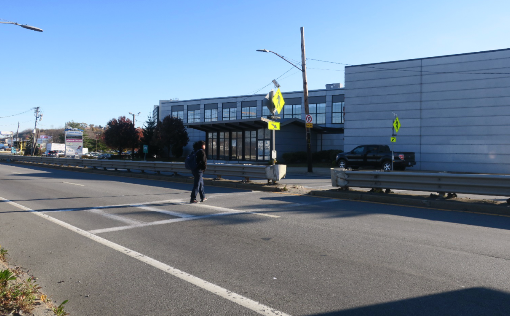
Video footage of the scene from WCVB-TV showed a sedan with all of its airbags deployed stopped next to the median guardrail in the northbound lanes of Route 1A near the intersection with Curtis Street.
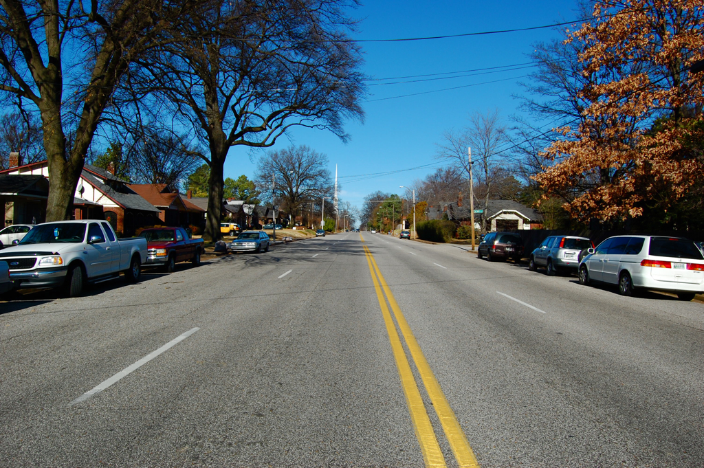
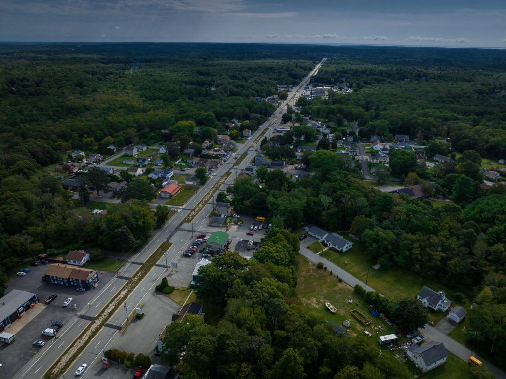
Route 1A/McClellan Highway is a congested four-lane road that becomes an elevated 6-lane expressway just south of Curtis Street. The road is surrounded by dense residential neighborhoods with high populations of non-white residents to the east, and industrial warehouses to the west.
Additionally, Curtis Street connects to the Chelsea Street Bridge, one of only two pedestrian connections between East Boston and Chelsea.
There are only two legally-sanctioned ways to cross Route 1A in the vicinity of the crash site. One is Saratoga Street, a quarter-mile to the southwest, and the other is a crosswalk at Addison Street, 1,000 feet to the northeast.
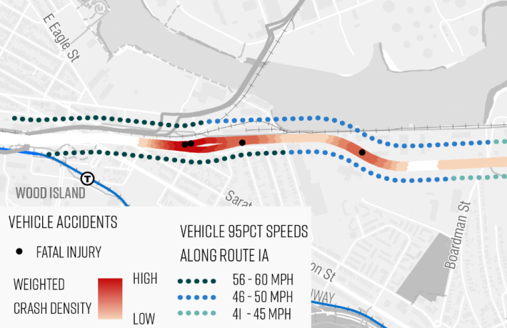
The Addison Street crosswalk is a double-threat crosswalk with flashing lights mounted to signs on each side of the roadway, but there is no stop signal, and MassDOT speed data indicates that drivers frequently drive at speeds in excess of 45 mph through the area.
In 2021, MassDOT commissioned a new Route 1A Corridor Study whose goals were to “improve safety for people using all modes of transportation (walking, biking, transit, driving, etc.)” and to “expand and enhance connectivity for users of all modes of transportation along and across the Route 1A corridor.”
That study identified the Curtis Street intersection as a “conflict point with high crash history, including fatalities.” Drivers have killed three people in the vicinity of the Route 1A-Curtis Street intersection since 2016.
MassDOT’s Route 1A Corridor Study remains incomplete, and there have been no public meetings for a full year.

Read More:
Streetsblog has migrated to a new comment system. New commenters can register directly in the comments section of any article. Returning commenters: your previous comments and display name have been preserved, but you'll need to reclaim your account by clicking "Forgot your password?" on the sign-in form, entering your email, and following the verification link to set a new password — this is required because passwords could not be carried over during the migration. For questions, contact tips@streetsblog.org.