Eyes On the Street: Better Bike Lanes For Allston and Brighton
The Boston Transportation Department has been busy in Brighton this fall: the city has reconfigured three neighborhood streets to calm traffic and add separated lanes for bikes and scooters.
These projects are part of Mayor Wu’s Everybody Deserves Safe Streets initiative, which aims to put put 35 percent of Boston’s residents within a 3-minute walk of a protected bike lane.
The three projects are in various stages of completion, but the city expects them to be finished within the next couple of weeks. We took a ride through the neighborhood last Friday to check them out.
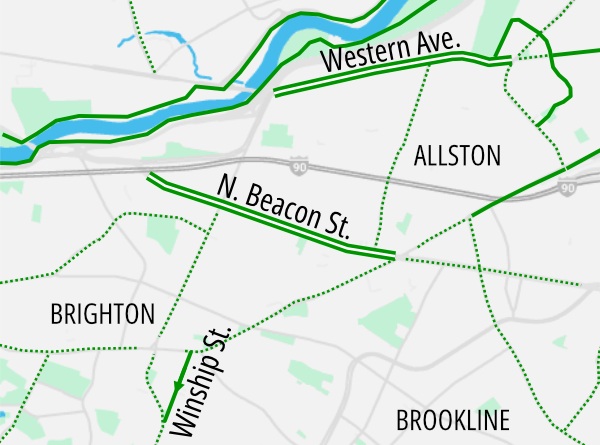
Winship Street
Anyone who’s ridden a bike around Brighton is familiar with the ridge of hills that divide Washington Street in Brighton Center from the Cleveland Circle and Chestnut Hill Reservoir neighborhoods to the south.
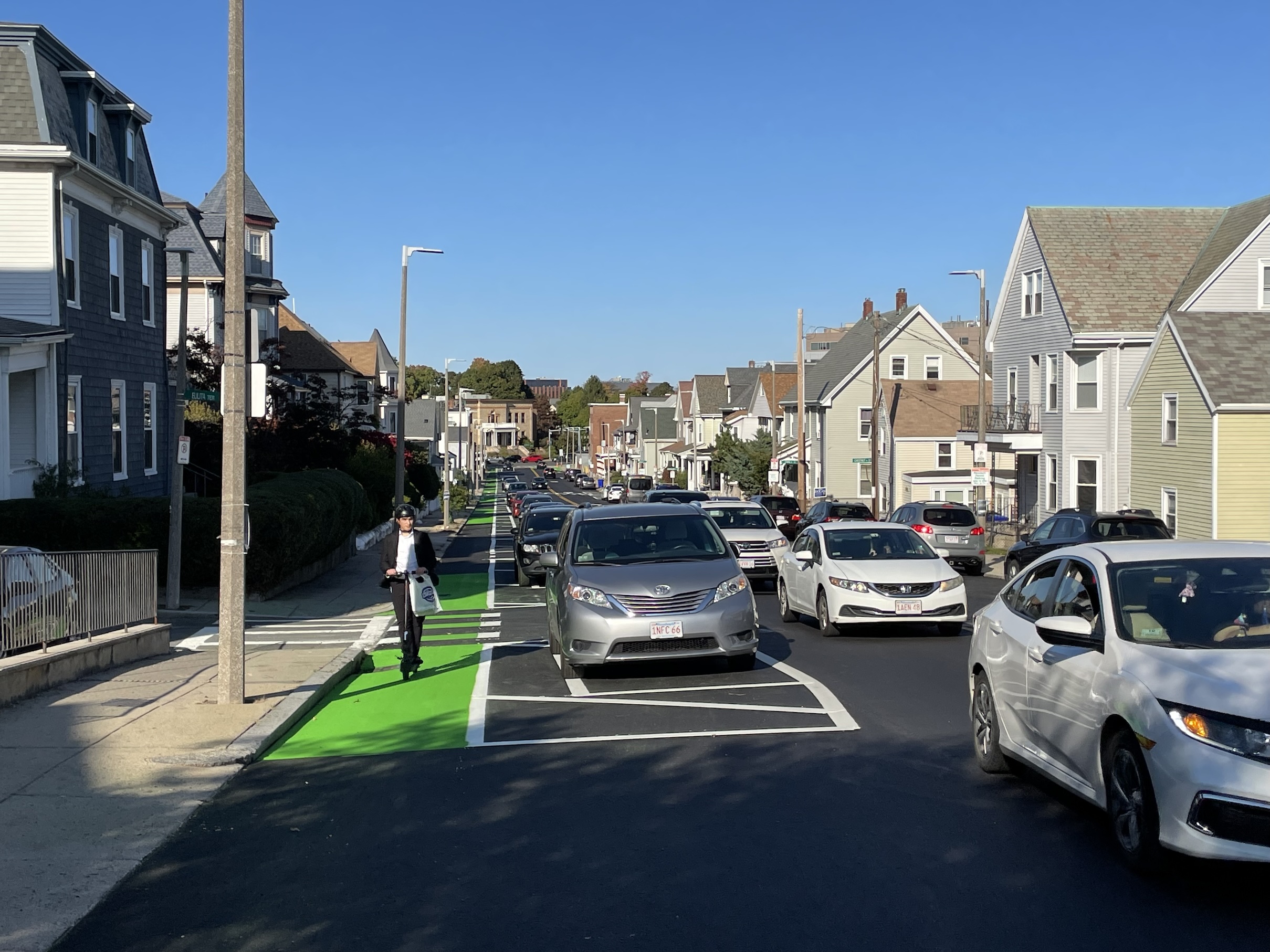
A new parking-protected bike lane on Winship Street should make it a little easier to get over that hill.
The new street design only has one bike lane, running in the uphill direction from north to south, but it’s buffered from moving traffic with a row of on-street parking, and gives people plenty of room to negotiate the incline.
The bike lane begins on Washington Street in the heart of Brighton Center, near the front entrance to St. Elizabeth’s Medical Center. A few blocks to the south, at the top of the hill, it connects to an existing painted bike lane on Chestnut Hill Avenue in Jackson Square.
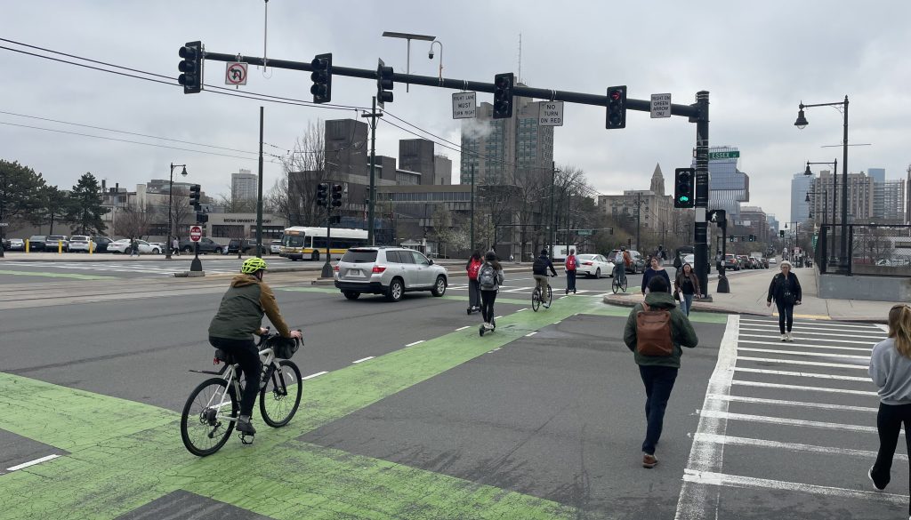
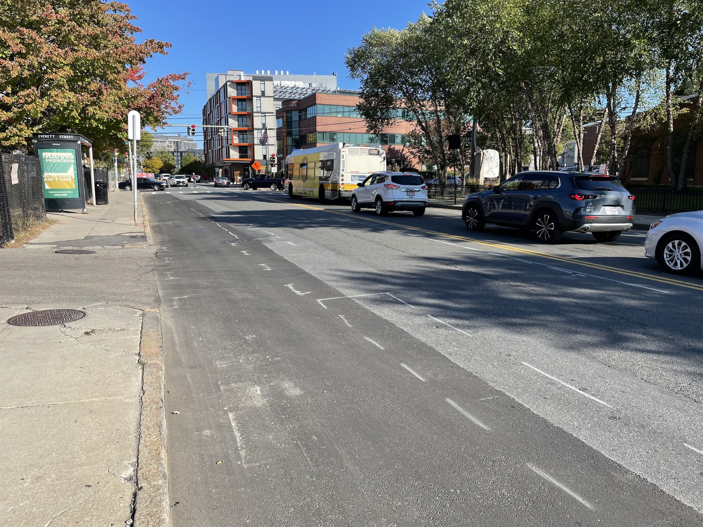
North Beacon Street
A few blocks to the north, the city also recently repainted North Beacon Street between Birmingham Parkway and Union Square to replace underutilized on-street parking lanes with new flexpost-separated bike lanes:
The Boston Transportation Department expects to install flexible post bollards along these new lanes later this week.
To the east, this new bikeway connects to Allston’s Union Square, where a pair of shared bus-and-bike lane continues to connect with the Commonwealth Avenue bike lanes in Packard’s Corner. It also connects to Everett Street, one of the neighborhood’s few north-south connections across the Massachusetts Turnpike.
On its western end, the new North Beacon Street bike lane dead-ends at the Department of Conservation and Recreation’s Leo Birmingham Parkway. That road is currently a blighted four-lane speedway, but the state is now reviewing construction bids on a project that will tear up two lanes of pavement to create a separated shared-use path for bikes and pedestrians.
Western Avenue
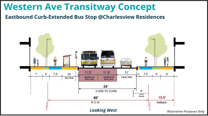
Finally, on the northern side of Allston near the Charles River, the city is moving forward with long-standing plans to install protected bike lanes along Western Avenue, from the Charles River Speedway to Barry’s Corner.
This project is less far along than the other two, but Boston Transportation Department officials told StreetsblogMASS that new roadway markings could appear within the next week.
Crews have already roughed-in the new lane markings with spray paint (see photo below). The street will have a similar configuration as North Beacon, with curbside lanes separated from traffic with flexible-post bollards.
This project will be an interim step towards the city’s longer-term plans to build sidewalk-level bike lanes and a new dedicated transitway on Western Avenue, as taller buildings replace warehouses and parking lots in the surrounding neighborhood.

Read More:
Streetsblog has migrated to a new comment system. New commenters can register directly in the comments section of any article. Returning commenters: your previous comments and display name have been preserved, but you'll need to reclaim your account by clicking "Forgot your password?" on the sign-in form, entering your email, and following the verification link to set a new password — this is required because passwords could not be carried over during the migration. For questions, contact tips@streetsblog.org.