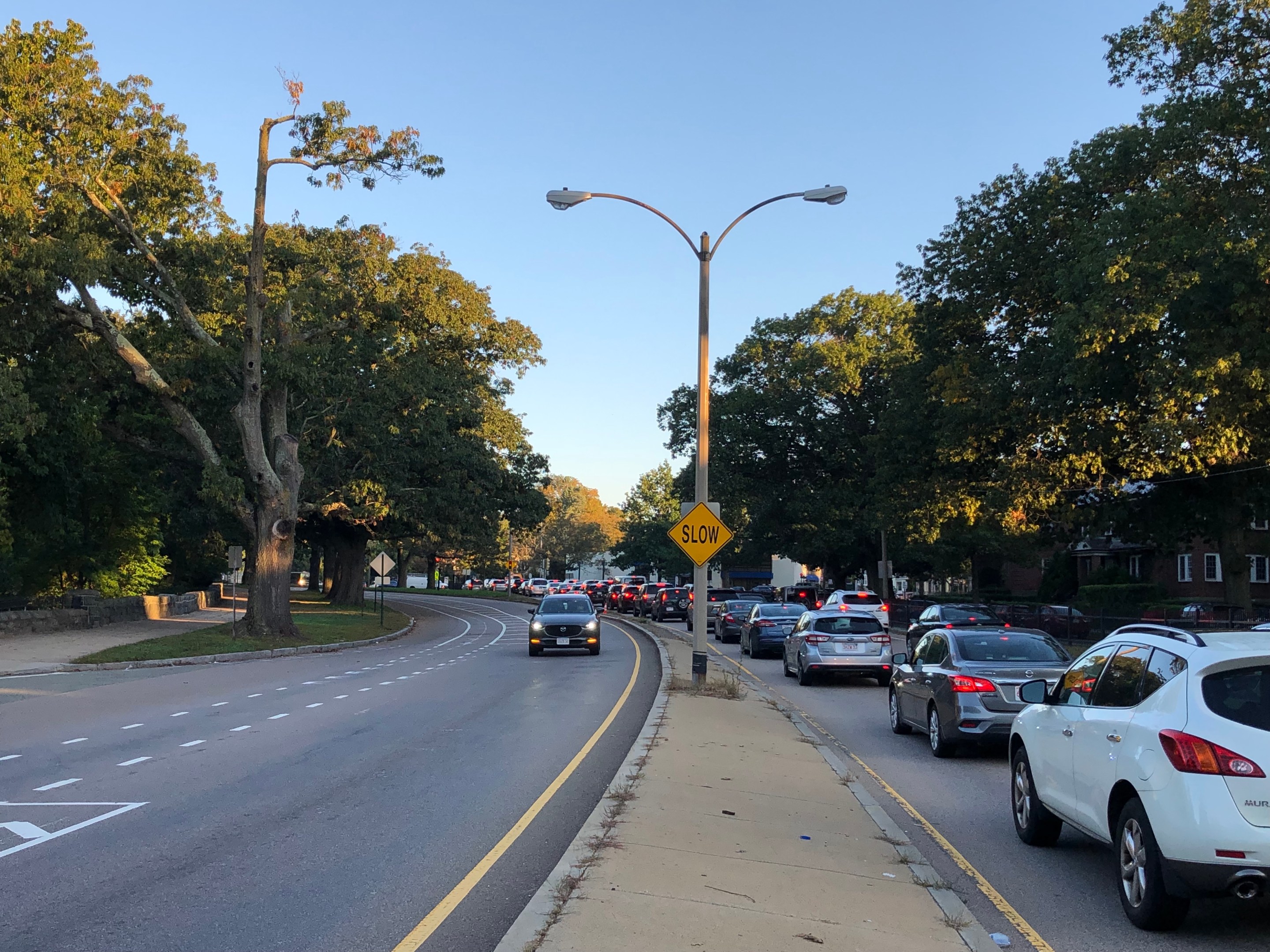
The state government's efforts to redesign the Arborway, an Emerald Necklace park in Jamaica Plan that's been taken over by unruly mobs of suburban drivers, will continue for at least another two years, according to state officials.
On Tuesday evening, officials from the state's Department of Conservation and Recreation joined their longtime design consultants from Howard Stein Hudson to share yet another iteration of a roadway re-design that's been discussed since 2020.
The DCR's "Arborway Improvement Project" dates to 2019. The project is focused on the mile-long stretch of multi-lane highways between Jamaica Pond and the Forest Hills T station.
Though it's technically a "park" designed by Frederick Law Olmsted, suburban drivers have taken over the area, threatening each other and other park-goers with frequent acts of violence.
During 2024, MassDOT's official crash database recorded 56 crashes on the short segment of the Arborway between the Arnold Arboretum entrance and Jamaica Pond. 14 of those crashes caused a significant injury to at least one victim.
The plan that officials presented on Tuesday evening is a refinement of the same plan DCR presented in its last public meeting for the project, which StreetsblogMASS reporter Grecia White covered two years ago.
Broadly speaking, the project would replace two large and chaotic rotaries – the ovoid "Kelley Circle" near Jamaica Pond and "Murray Circle" where the Arborway and Centre Street meet – into 6-lane signalized intersections.
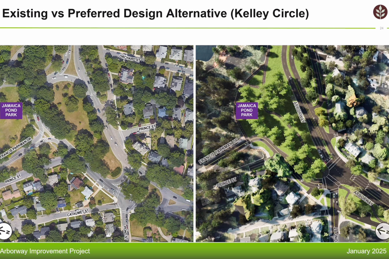
The plan also calls for new multi-use pathways and signal-protected crosswalks to create safe bike and pedestrian connections between Forest Hills, the Arnold Arboretum, Centre Street, and the rest of the Emerald Necklace.
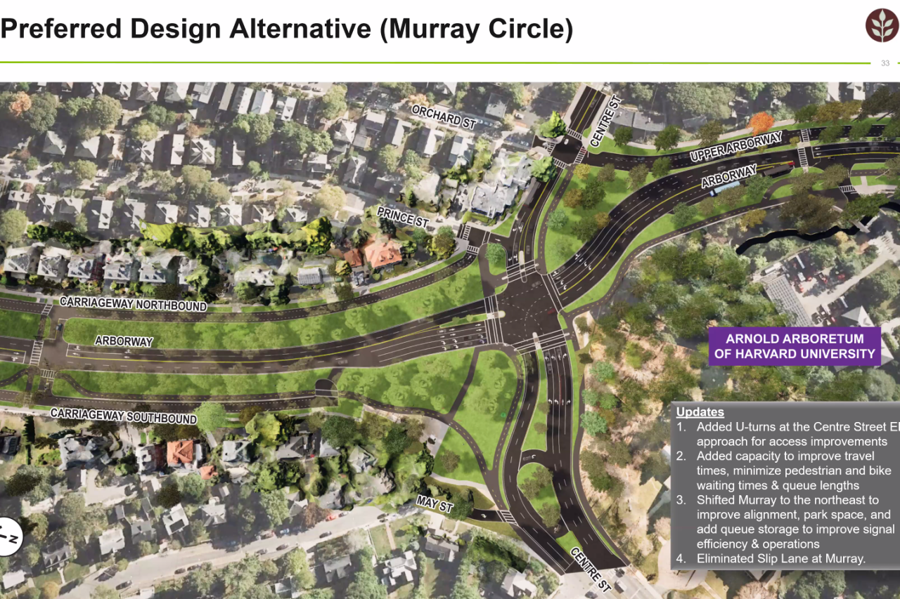
There are, however, some key differences. At the Kelley Circle intersection, for instance, project designers have added more turning lanes, but eliminated a right-turn "slip lane" where turning traffic would have been allowed to go from the Arborway to Centre Street westbound without stopping:
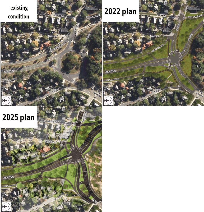
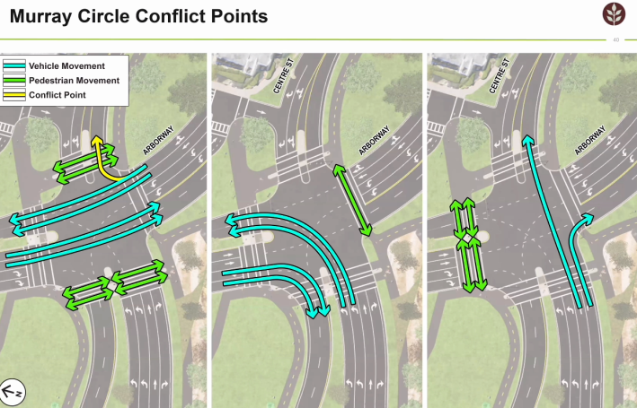
That revision means that pedestrians will have longer crossings, across 6 lanes of traffic on three sides of the new intersection.
But in theory, dedicated lanes and signals for right-turning traffic will also give pedestrians a chance to cross the Arborway and Centre Street without worrying about turning vehicles when the walk signal is on – if drivers obey their traffic signals:
DCR engineer and Director of Transportation Jason Santos admitted that many of these design choices are being made to make the Arborway "as efficient as actually possible for a vehicle to get through."
But neighborhood residents pointed out that subsidizing traffic by sacrificing public parkland for highway lanes would only encourage more driving, and more regional congestion.
"As long as you try to keep the Arborway free-flowing and quick, it encourages more drivers to drive that way," observed Jamaica Plain resident Eric Herot. "Google Maps will literally route them that way because it's a shorter route. You can't win that battle with extra capacity."
Construction won't start 'til late 2026
"We'll have another public meeting for the 75 percent design, and additional public comment and meetings when we go through the permitting process," said John Cavanaro, a DCR engineer and project manager. "And after that we'll hone this down to final construction bid drawings, that we are shooting to put out to bid at the end of next year."
An accompanying slide suggested that the 75 percent design public hearing would be held this fall.
Learn more about the project and weigh in on the preliminary design here:
https://www.mass.gov/info-details/arborway-improvement-project
A copy of Tuesday evening's presentation should be posted later this week at this website.
