Truro Is Converting Part of An Obsolete Highway Interchange to Affordable Housing
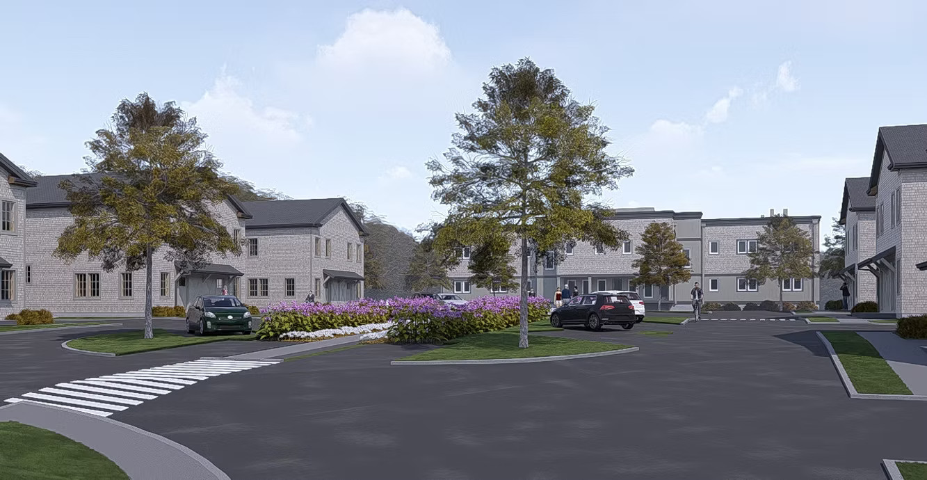
Earlier this month, elected officials in Truro gathered at the town’s community center to celebrate the official groundbreaking of a new 43-unit housing development on the site of an unbuilt MassDOT highway off-ramp.
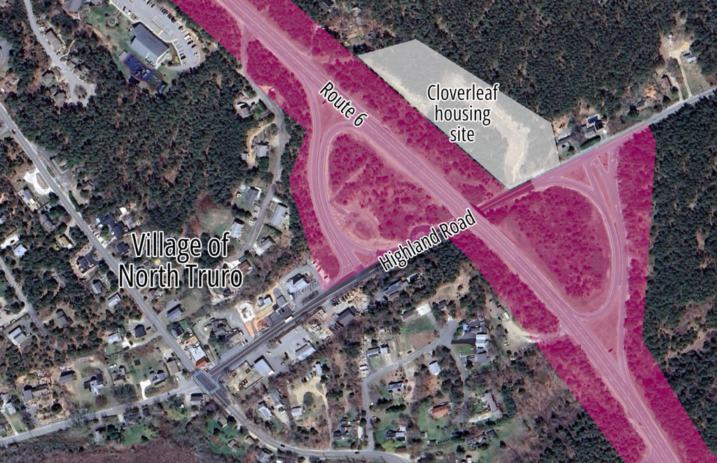
The new homes will be located near the junction of Route 6 and Highland Road, the main street for North Truro’s small village center (see map above). The project will include 43 new homes, and most of its units will be reserved for families who earn under 60 percent of the area’s median household income.
But what makes this project particularly noteworthy is the land it sits on. In a part of the Cape where real estate prices are notoriously expensive, this project took advantage of “free” land from MassDOT: 3.9 acres the agency had taken decades ago for a highway off-ramp that never got built.
In homage to the site’s history, the project’s developers are calling it the “Cloverleaf.”
And in a town where the need for affordable housing far exceeds the need for an expressway to the beach, the project begs the question: could MassDOT and its massive land holdings play a larger role in solving the Commonwealth’s housing crisis?
MassDOT’s big footprint
In part of Truro and adjoining Provincetown, Route 6 is a bizarre relic of MassDOT’s 20th-century highway-building binge.
In the southern part of Truro, and in the adjoining town of Wellfleet, the state highway is an ordinary two-lane road, lined with homes and small businesses.
But for 7 miles between North Truro and the beaches of Provincetown, Route 6 inexplicably bloats into a wide four-lane highway with large, freeway-style interchanges that funnel high-speed traffic onto tiny back roads.
MassDOT also owns a wide buffer of undeveloped land on either side of Route 6 (highlighted in pink in the map above). The state-owned right-of-way extends over 100 feet from each side of the roadway in North Truro.
A few miles to the west, the agency is also advancing plans to convert parts of Route 6 in Provincetown back into a normal 2-lane roadway.
Doing something similar in North Truro, by converting the Highland Road interchange into a roundabout or a normal four-way intersection, could free up acres of additional land for dozens, or even hundreds of additional affordable homes.
“It is an interesting idea to lower Route 6 and remove the cloverleafs. I don’t think Truro has ever approached the state to see if they would consider that,” Kelly Clark, Truro’s town manager, told StreetsblogMASS.
StreetsblogMASS also reached out to MassDOT’s press office to find out whether it was pursuing opportunities to support additional housing development on its unused land on Cape Cod, but the agency has not yet responded to our questions (we’ll update this story or write a follow-up when they do).
Clark did note that Truro is also moving forward with plans for up to 160 new affordable homes on the “Walsh Property,” an undeveloped 70-acre parcel behind the town elementary school that the town bought for $5.1 million in 2019.

Read More:
Streetsblog has migrated to a new comment system. New commenters can register directly in the comments section of any article. Returning commenters: your previous comments and display name have been preserved, but you'll need to reclaim your account by clicking "Forgot your password?" on the sign-in form, entering your email, and following the verification link to set a new password — this is required because passwords could not be carried over during the migration. For questions, contact tips@streetsblog.org.