Driver Kills 68-Year-Old Victim Who Was Walking Near Haverhill Highway Interchange
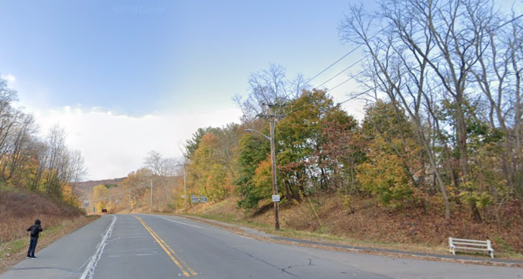
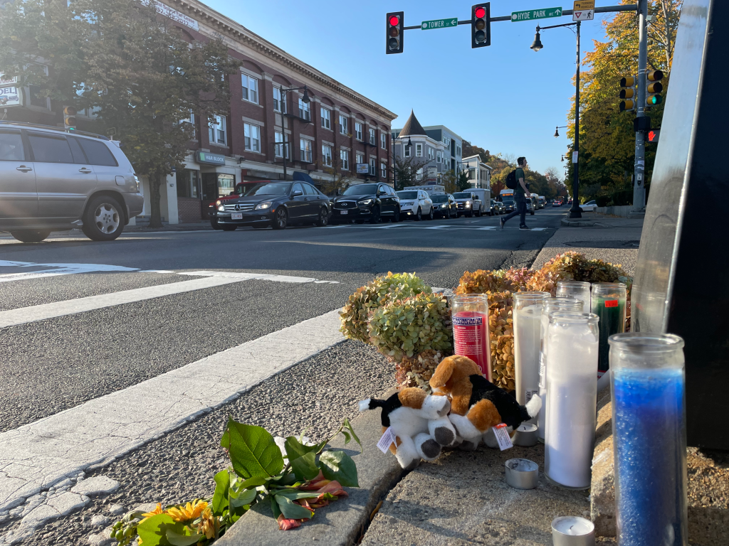
Last Tuesday evening, a driver struck and killed Richard Cripps, a 68-year-old Haverhill resident, while he was walking on River Street near the Interstate 495 interchange in Haverhill.
According to police reports, an unidentified suspect killed Cripps around 8 p.m. on the evening of Nov. 25 on River Street, also known as Route 113, near its intersection with Hunter Avenue.
Police allege that the crash involved at least three different vehicles. Initial police reports suggested that the driver of a Volvo SUV struck and killed Cripps, but details of what happened remain under investigation.
On Monday, the Office of Essex County District Attorney Paul F. Tucker identified the victim as Cripps in response to an inquiry from StreetsblogMASS.
The District Attorney’s office declined to answer our questions about the suspected killer’s identity, or whether they will face any charges for the homicide.
Crash site features lethal speed limit, inadequate sidewalks
The site of last week’s crash features several well-known risk factors for traffic violence.
Hunter Avenue is one block away from a T-shaped intersection of on- and off-ramps to and from Interstate 495.
There, a wide “slip lane” allows high-speed traffic coming off from the Interstate to merge onto River Street westbound without stopping:
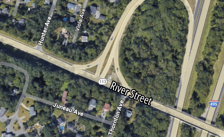
Immediately west of that off-ramp is a speed limit sign that declares a speed limit of 45 miles per hour.
A pedestrian who gets hit by a driver who’s traveling at that speed faces a 90 percent risk of serious injury and a 50 percent chance of death, according to research from the AAA Foundation for Traffic Safety, and those risks are increased even further if the vicim is a child or an older adult.
River Street also lacks safe sidewalks and crosswalks. In the vicinity of the crash site, there’s only one sidewalk, on the north side of the street, where it takes a meandering path across all four lanes of the Interstate 495 ramps.
There are no marked crosswalks to connect that sidewalk to the suburban residential neighborhood on the southern side of the street.

Read More:
Streetsblog has migrated to a new comment system. New commenters can register directly in the comments section of any article. Returning commenters: your previous comments and display name have been preserved, but you'll need to reclaim your account by clicking "Forgot your password?" on the sign-in form, entering your email, and following the verification link to set a new password — this is required because passwords could not be carried over during the migration. For questions, contact tips@streetsblog.org.