Eyes on the Street: The Fall of a Freeway in Fall River
For the past three years, contractors for MassDOT have been tearing down an obsolete 20th-century expressway along Fall River’s waterfront and building a grid of new surface streets in its place – part of the city’s effort to cultivate new development near its new regional rail station.

We covered this project three years ago for its ceremonial groundbreaking, and yesterday, we rode on the new Fall River/New Bedford line to check out the project as it approaches completion.
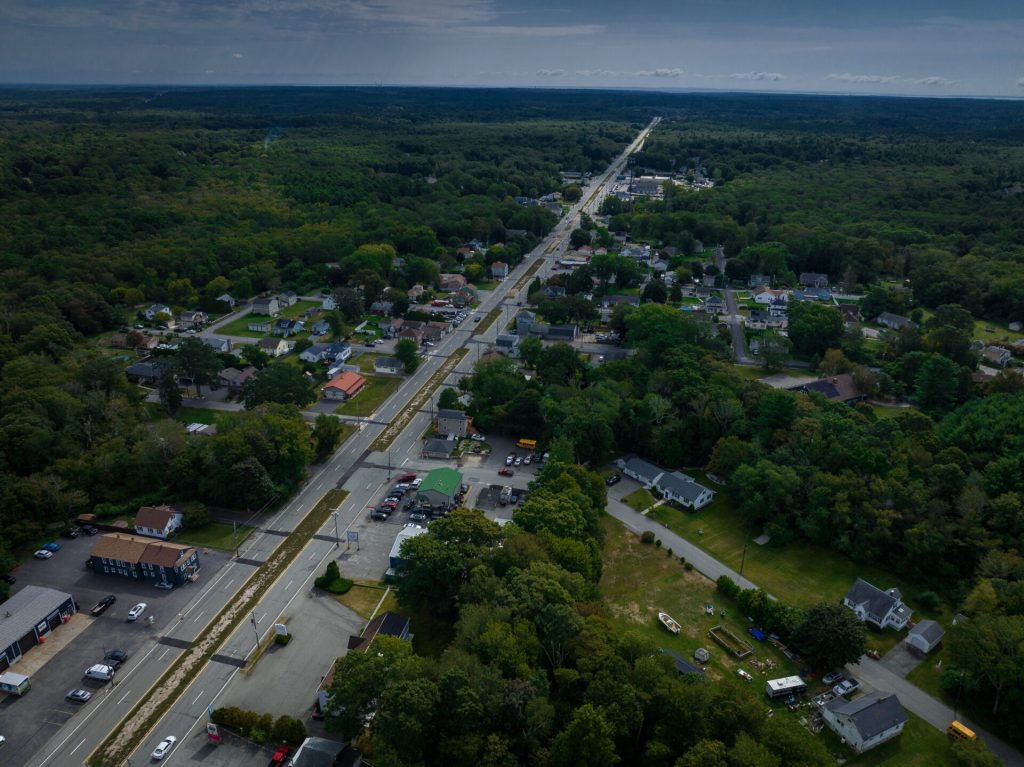
First, though, here’s what Route 79 used to look like, up until the end of 2022:

And here’s a ground-level view of what it looks like today:
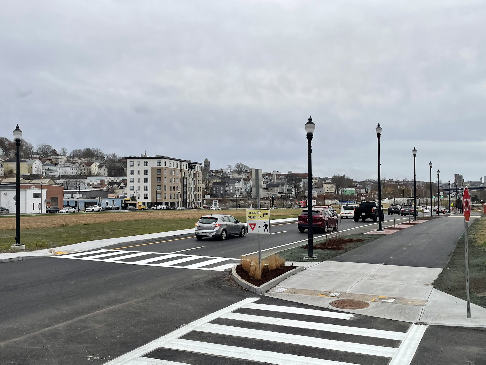
A new shared-use path parallels the waterfront side of the new Davol Street, connecting several of Fall River’s riverfront parks. One of those parks, the Senator Thomas Norton City Pier, near the end of Turner Street, opened during the project’s construction in 2022.
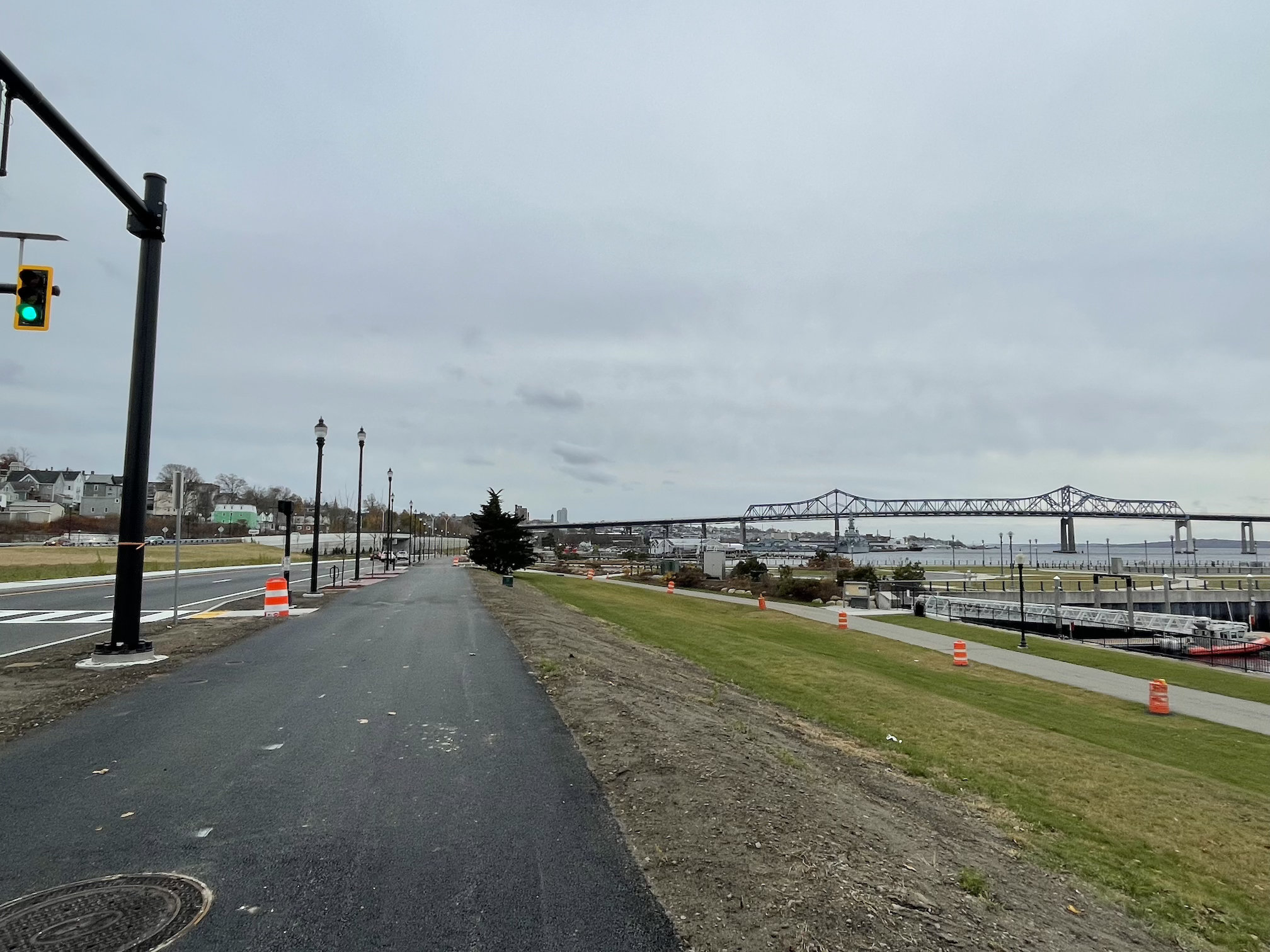
A second shared-use path, connected to the waterfront path at several cross-streets, runs along the east (inland) side of the former expressway, next to the northbound lanes of Davol Street.
The inland path connects to the MBTA station as well as to an existing shared-use path system across the Veterans’ Memorial Bridge (Route 6) into the neighboring town of Somerset, which is part of the envisioned South Coast Bikeway from Rhode Island to Cape Cod.
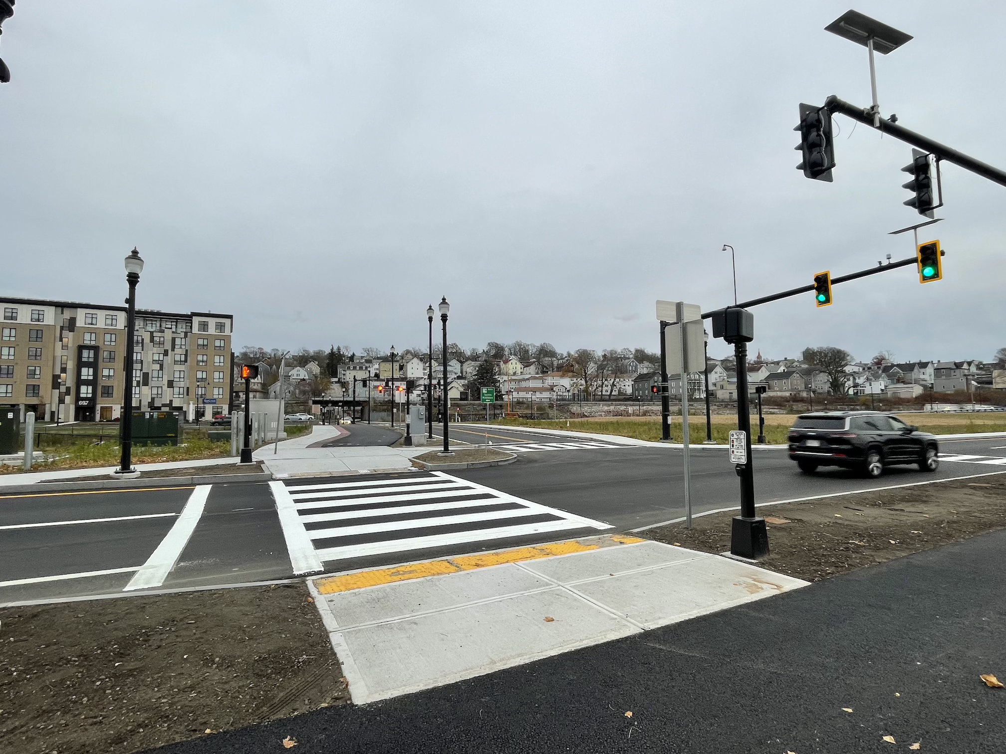
The overwhelming first impression of the project is how much empty space there is in this neighborhood now that the four-lane expressway is gone.
The project spans about one mile of riverfront, from just south of the Route 6 Veterans Memorial Bridge to Battleship Cove. At its widest point, at Brightman Street (pictured below), the highway right-of-way was over 600 feet wide.
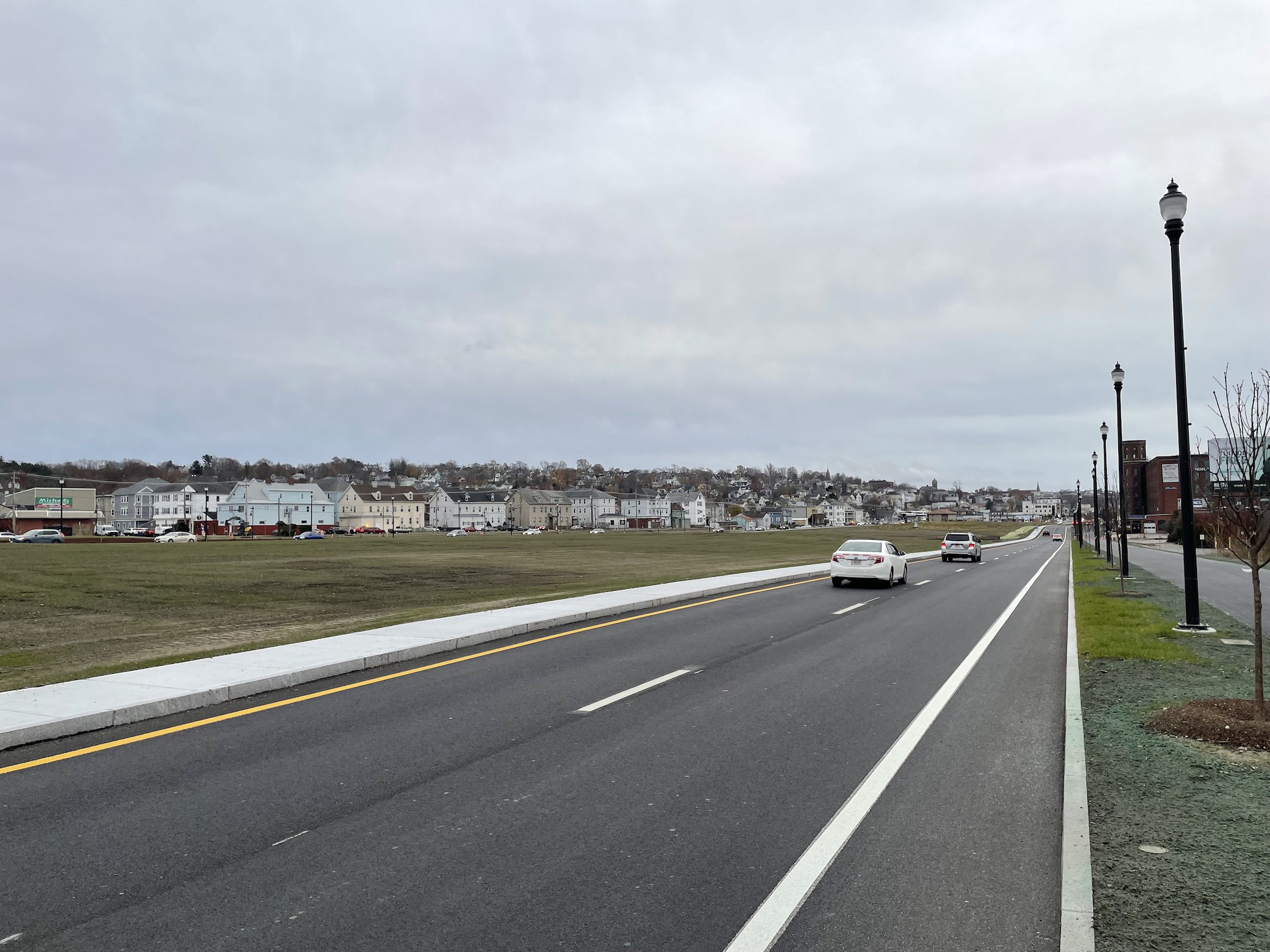
These photographs don’t quite do it justice – there’s a massive amount of empty real estate here. Even in its new, narrowed condition, Davol Street still looks and feels a lot like an interstate highway for the time being (albeit one lined with sidewalks and nice street lamps).
However, the City of Fall River’s Redevelopment Authority is marketing a new plan for the area that envisions new mixed-use buildings with over a thousand new homes, along with street-level retail spaces along the new Davol Street.
The city and MassDOT anticipate offering about 19 acres of land for redevelopment, in addition to 8 acres of new green space at the northern and southern ends of the project area.
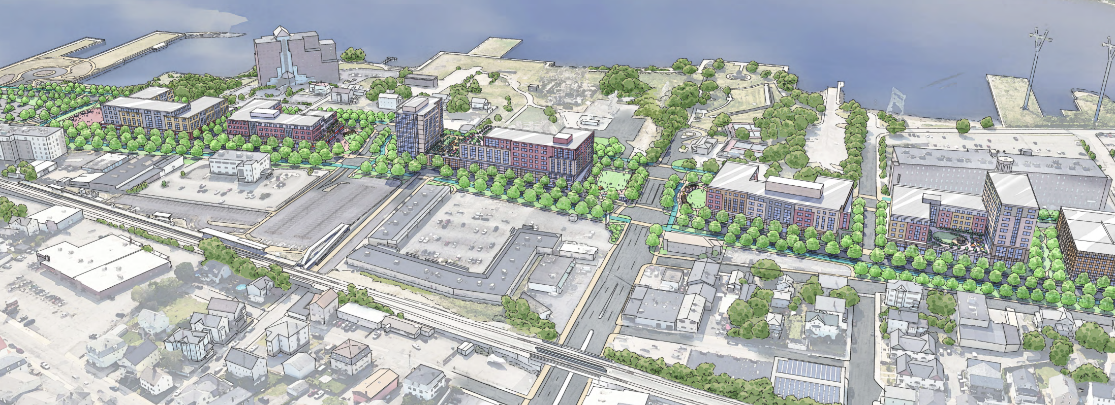
Fall River’s City Council has approved a “Waterfront and Transit-Oriented Development District” designation for the entire area. That zoning allows for buildings up to 6 stories high, or 12 stories with a special permit from the city’s zoning board.
However, the existing “transit-oriented” zoning also requires developers to build at least 1.25 parking spaces for every new apartment – a costly requirement that is likely to hinder investment, bring more traffic into the neighborhood, and undermine the neighborhood’s value for car-free households.
Another challenge for the district is that, while the highway barrier is finally gone, the area is still fairly isolated from the rest of Fall River. MassDOT made relatively few changes to the southern end of the Davol Street corridor, closest to downtown, where the street still merges into a highway interchange with Interstate 195.
Along the rest of Davol Street, the elevated MBTA rail line and a steep hillside limit the number of cross-streets that connect this district from the established inland neighborhoods along North Main Street.
Nevertheless, developers are already signaling their interest in the area. In October, developers won zoning board approvals for a new 8-story building with 160 apartments at the corner of Davol and Turner Streets, on privately-owned land east of the former expressway’s right-of-way.

Read More:
Streetsblog has migrated to a new comment system. New commenters can register directly in the comments section of any article. Returning commenters: your previous comments and display name have been preserved, but you'll need to reclaim your account by clicking "Forgot your password?" on the sign-in form, entering your email, and following the verification link to set a new password — this is required because passwords could not be carried over during the migration. For questions, contact tips@streetsblog.org.