Another Federal Funding Fumble: Boston Loses $8.15 Million for Safety Project At Deadly Fenway Intersection
Another significant infrastructure investment has slipped through the city’s fingers after Boston’s Streets Cabinet failed to finalize plans in time for a major safety improvement project in the Fenway neighborhood.
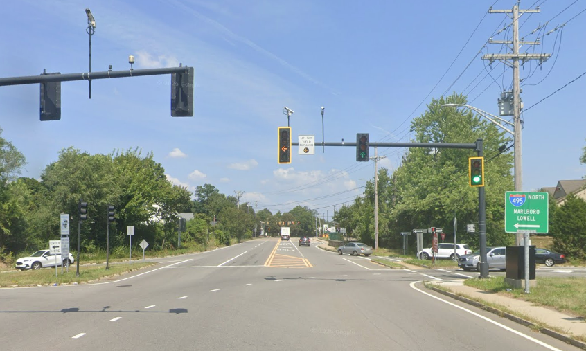
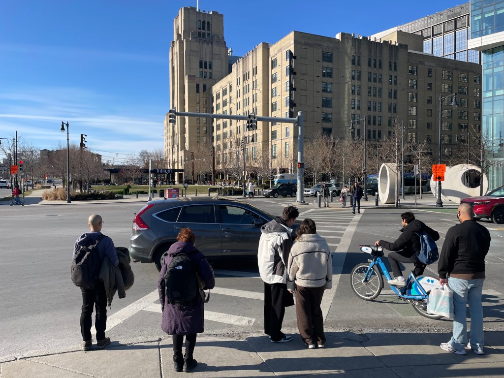
Since 2011, the City of Boston has been planning a federally-funded project to repair and address urgent safety hazards at the complex intersection of Park Drive, Boylston Street, and Brookline Avenue – an important connection between the Fenway and the Longwood Medical Area.
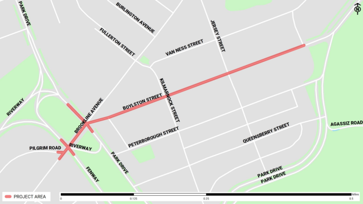
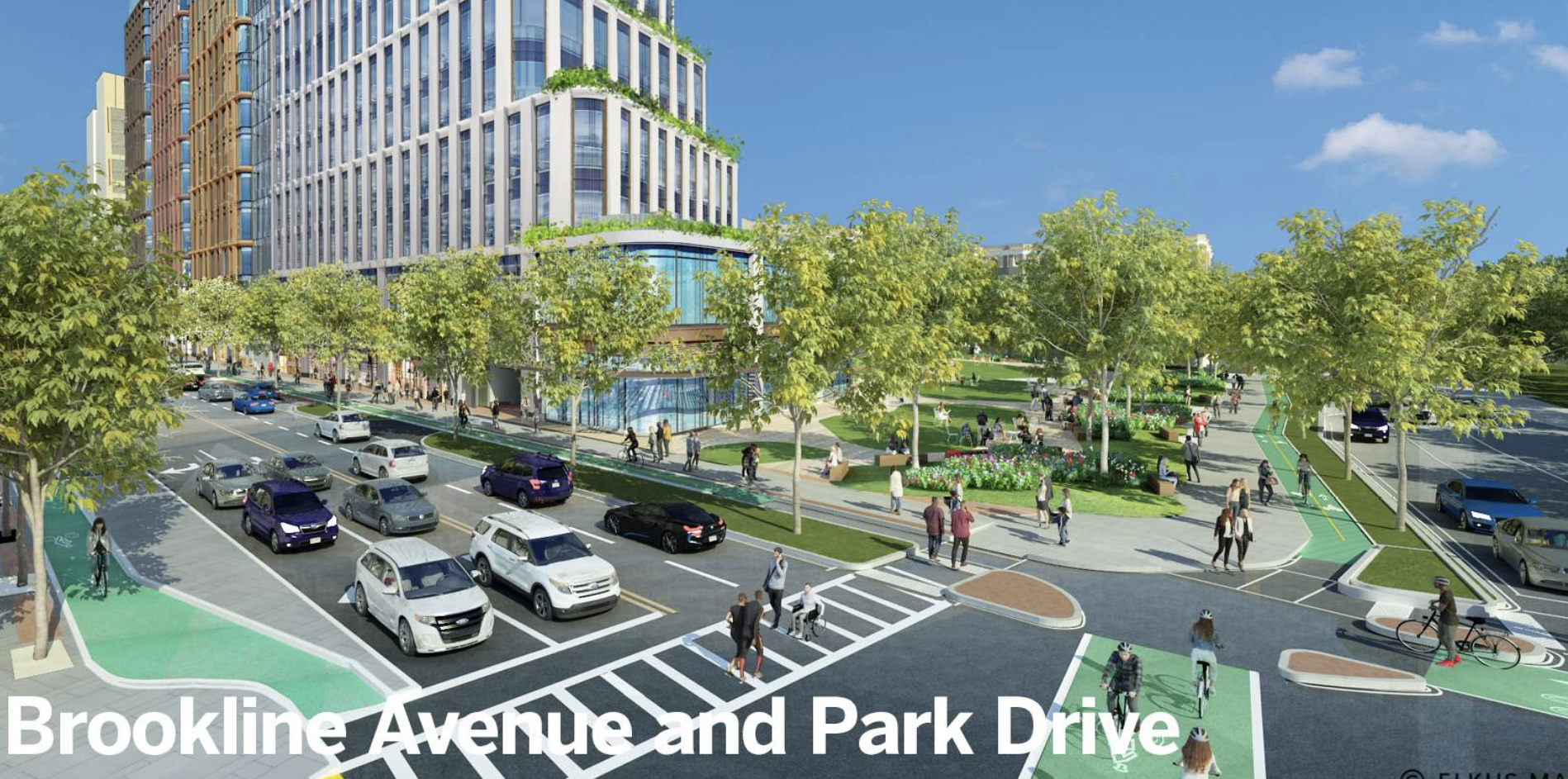
More recent iterations of the project would have also rebuilt adjacent parts of Brookline Avenue and Park Drive with a focus on improving bike and pedestrian networks and bringing street infrastructure up to a state of good repair.
In 2022, a Boston Transportation Department spokesperson told StreetsblogMASS that the city was planning “a two-way cycle track on the south side of the Muddy River crossing (the segment of Brookline Avenue between Park Drive and Fenway), as well as a two-way cycle track connecting north along Park Drive to the Fenway Path through the Landmark Center site,” plus the reconstruction of the Boylston Street separated bike lanes with permanent curbing.
The project had been budgeted to receive $8.15 million in federal funds for fiscal year 2026, which ends on June 30th.
But at meeting last week of the Boston Metropolitan Planning Organization (MPO), the regional council that allocates federal transportation funds for eastern Massachusetts, members voted to remove the project from the region’s five-year transportation improvement plan, noting that it “it is not likely to advertise (for construction)” anytime soon.
Across the city, work on long-planned infrastructure upgrades, from neighborhood speed humps to major transit projects, has slowed dramatically since Mayor Wu issued her so-called “30-day review” of transportation projects a year ago.
In addition to the Fenway project, the city has also lost a $20 million grant federal grant intended for three major streets in Roxbury in part because City Hall neglected to secure a formal grant agreement in the three years after the initial announcement.
And as we reported last week, senior officials at City Hall have also deliberately delayed final design work on a new bus transitway on Columbus Avenue, putting the city and the MBTA at risk of losing another $34 million in federal transit funding.
Safety first… someday
This intersection of Boylston Street and Park Drive has been flagged as a “top crash location” under state and federal safety criteria.
In the winter of 2019, the driver of a cement truck driver struck and killed Paula Sharaga, a beloved Brookline librarian, while she was riding her bike through the intersection.
The federally-funded redesign was supposed to “prioritize pedestrian safety and accessibility, while bringing the corridor into a state of good repair,” according to a project webpage on Boston.gov.
That same website says (at the time of this article’s publication) that work will begin by 2027.
Even if it still had the necessary funding, city officials admitted in MPO meetings last month the city was not going to meet that timeline.
At the March 16th “Process, Readiness, and Engagement” committee meeting for the Boston MPO, Brad Rawson, the City of Somerville’s Director of Transportation and Infrastructure, noted that there had been no public updates on the Boylston Street project since 2021, when the city submitted a “25 percent” design package (the “25 percent” design sketches out the overall geometry of a construction project, and initiates the final design process to produce detailed construction blueprints within another one to two years).
Jen Rowe, a planner for the Boston Transportation Department who also chairs the MPO Readiness Committee, then revealed that the city has discarded the 2021 design, and gone back to the drawing board to design a new, scaled-down project.
According to Rowe, negotiations over the segment of Brookline Avenue through the Fens parkland, which is owned by the state Department of Conservation and Recreation (DCR), had been a sticking point.
Rowe said that while DCR had supported the city’s 2021 designs, the agency “ultimately decided to address that area as part of a Park Drive feasibility study that they are leading, and we are working very closely with them now.”
“We are now at a point where we have begun conversations with some of the major stakeholders,” Rowe continued. “We plan to host a public meeting in late April. We wanted to respond to some of the feedback, make sure we’re getting out before the community and sharing what’s planned,” said Rowe.
Rowe also insisted that “the project is still a priority of the city’s,” and noted several of the serious safety risks that the public will suffer as a result of the project’s ongoing delay.
“It’s on our high-crash network for pedestrians,” said Rowe. “It’s just a very high volume of people and activity in that area, going to the different venues like Fenway and MGM… As you know, it’s a four-lane cross-section now, so a high threat, many opportunities for the double-threat crashes there.”
Another try in 2031
At its regular monthly meeting on March 19, the full board of the Boston MPO voted to recommend an amendment to its five-year plan that formally removes the Boylston Street project from the workplan.
That change freed up $8.15 million in federal funds to help finance other shovel-ready regional projects, including a project to build new elevators for improved accessibility at the Downtown Crossing MBTA subway station.
Adriana Jacobsen, a transportation planner for the MPO, explained that the project would be “proposed for funding in 2031” in the MPO’s next five-year plan, which the MPO board is expected to vote on later this spring.
Still, other MPO members warned that Boston’s indecision in streets projects was affecting the entire region’s ability to execute transportation improvements.
“As project managers, you often run into, you know, a point where you’re looking for guidance for leadership, and that might not be there, and that’s what causes delay,” said Eric Bourassa, a regional transportation planner on the MPO board. “I think it’s important for those leaders to hear that not making those decisions, it isn’t just deferring things in the city, it has this impact on the whole TIP (transportation improvement program) and I don’t know if that’s fully understood… Pushing this out into 2031 means that we’ll have less funding for other projects.”

Read More:
Streetsblog has migrated to a new comment system. New commenters can register directly in the comments section of any article. Returning commenters: your previous comments and display name have been preserved, but you'll need to reclaim your account by clicking "Forgot your password?" on the sign-in form, entering your email, and following the verification link to set a new password — this is required because passwords could not be carried over during the migration. For questions, contact tips@streetsblog.org.