Bond Bill Boosts Proposal to Reconfigure Boston’s Charles Circle
The new transportation bond bill that passed in the legislature earlier this week earmarks over $100 million for a project that could reconfigure Storrow Drive to create more riverfront parkland on the Charles River Esplanade near the Longfellow Bridge.
The text of House bill 5248, which passed nearly unanimously in both chambers of the legislature early on Tuesday morning, includes the following language:
“Not less than $108,000,000 shall be expended for… the planning, design, development and construction of the relocation of a portion of Storrow Drive and its access ramps to Charles circle as necessary to consolidate the westbound lanes of Storrow Drive with the eastbound lanes under a single arch of the Longfellow bridge and the restoration to parkland and gardens … contiguous with the Esplanade parkland.”
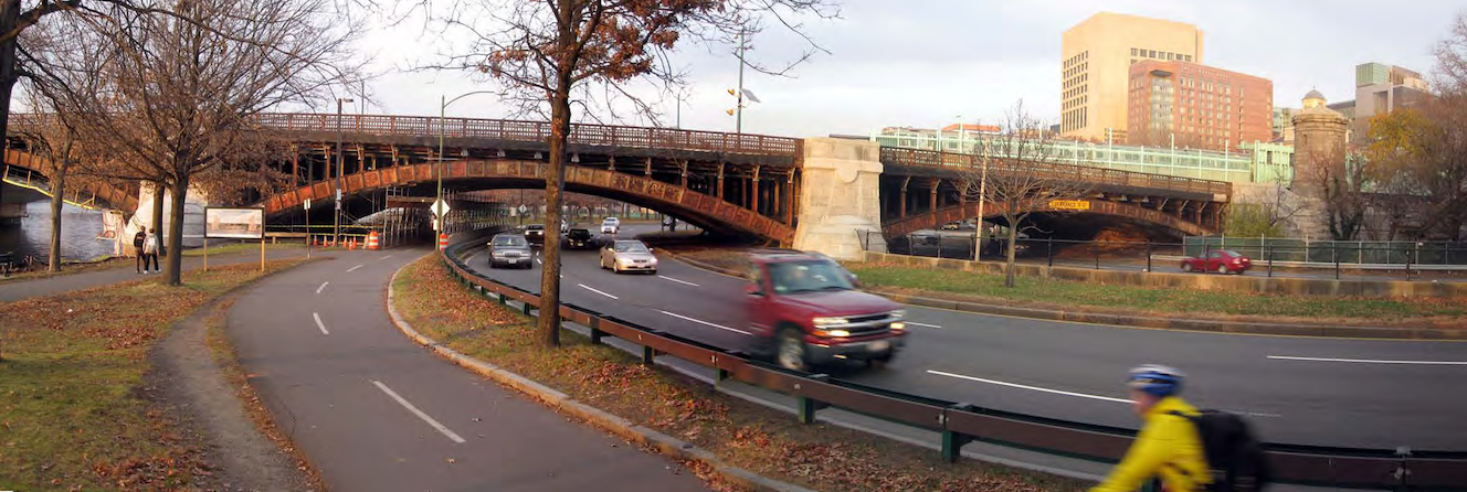
Storrow Drive currently sprawls under two of the Longfellow Bridge’s broad archways (see above), but the idea of consolidating the roadway under a single arch, and repurposing the former westbound lanes as new riverfront parkland, has been circulating for most of the past decade.
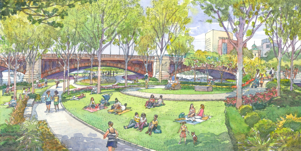
“Uniting (the westbound lanes) comfortably with the eastbound lanes under the inland arch (would) free the full width of the riverside arch for restoration as parkland… (and create) 75 feet of usable parkland to Charlesbank at a critical choke point,” suggested the Esplanade Association’s “Esplanade 2020” report published in 2012.
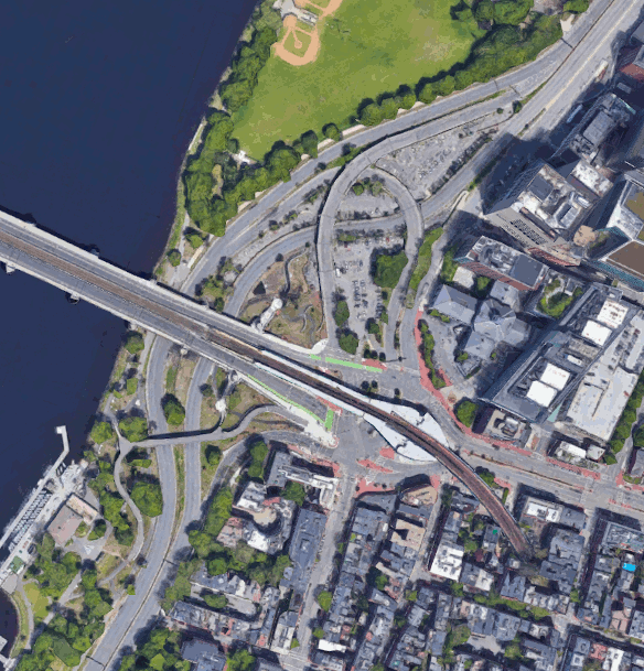
The reconfiguration could also provide real estate for a proposed expansion of the adjacent Massachusetts Eye and Ear Infirmary (MEEI), which currently leases the surface parking lots that lie under Storrow Drive’s ramps north of Charles Circle.
In 2014, Massachusetts lawmakers enacted another bill, Chapter 272 of the Acts of 2014, that authorizes the state to enter into a long-term lease for the real estate under the highway ramps “to facilitate the expansion of the MEEI Facility to add approximately 240,000 square feet in fifteen floors or more.”
That law also authorizes a realignment of Charles Street and the ramps between Charles Circle and Storrow Drive to let MEEI build a subterranean parking garage, with new public parkland on the surface.
“The idea is that Mass. Eye and Ear would cover some costs of the project, and MassDOT would cover some costs,” says Rep. Jay Livingstone, the state representative whose district includes Back Bay, the West End, Cambridgeport, and parts of Kendall Square. “I hope that the people involved can follow through with it. It would be the largest expansion of Esplanade parkland in decades.”
There are not yet any official designs for the reconfiguration project, but the Esplanade 2020 report suggests that the highway ramps at Charles Circle could be eliminated altogether and replaced with at-grade intersections, “with the intent of transforming Storrow Drive from a high-speed and limited-access highway to a parkway that serves its adjacent neighborhoods and institutions.”
“There’s no timeline for these projects – it’s still not in the state’s five-year capital plan – and there’s no guarantee that something will happen,” warned Esplanade Association Executive Director Michael Nichols in a phone conversation on Thursday. “But it’s still a big step forward, and I’d like to credit Rep. Livingstone for getting this into the bill. We see this as a huge opportunity to improve connections to the park.”

Read More:
Streetsblog has migrated to a new comment system. New commenters can register directly in the comments section of any article. Returning commenters: your previous comments and display name have been preserved, but you'll need to reclaim your account by clicking "Forgot your password?" on the sign-in form, entering your email, and following the verification link to set a new password — this is required because passwords could not be carried over during the migration. For questions, contact tips@streetsblog.org.