MassDOT Officially Breaks Ground On Northern Strand Extension Through Downtown Lynn
The Northern Strand pathway is officially headed for the beach.
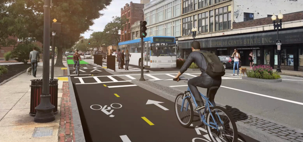
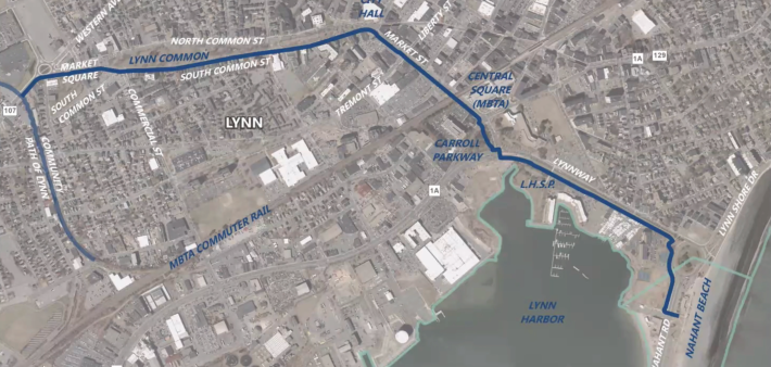
The new project will extend the existing Northern Strand trail with curb-separated, on-street bikeways and sidewalk improvements on city streets through downtown Lynn, and connecting to the existing beachfront bike path through the state-owned parkland at Nahant Beach:
Last Thursday, MassDOT officials visited Lynn to celebrate an official groundbreaking ceremony for the project.
“It’s a transit project that improves efficiency, but it’s also an environmental project. It helps in our efforts to address our climate issues,” said Lynn Mayor Jared Nicholson. “It’s a recreation project… I can tell you my boys and I are huge fans of the bike path and the linear park. And it’s an economic development project, and it helps us stitch back together our downtown with one of our most amazing resources here, the Atlantic Ocean.”
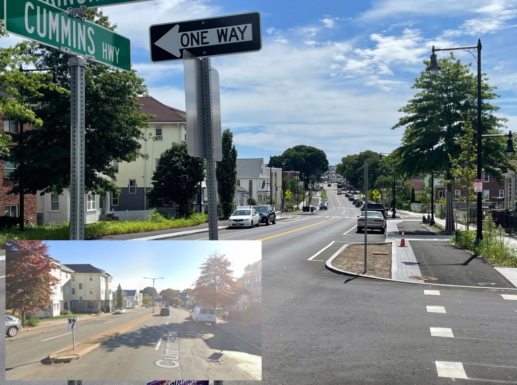
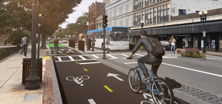
Project will improve streets across downtown Lynn
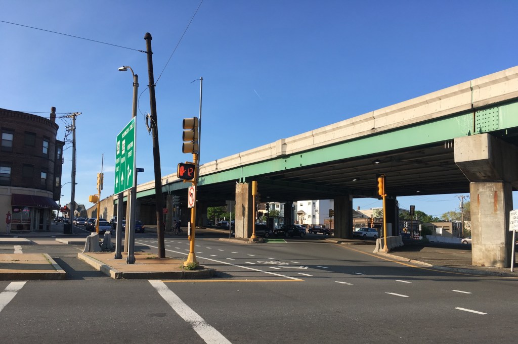
The Northern Strand Trail currently ends at Western Avenue, about one mile west of downtown Lynn.
This year’s construction will narrow several multi-lane roadways to create space for new two-way bikeways, improved sidewalks, safer crosswalks, and new bus stops.
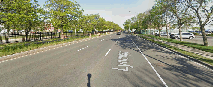
Along the Lynn harborfront, the trail will run along the Lynnway, a six-lane highway that the state’s Department of Conservation and Recreation (DCR) built to cut off access between the city and its waterfront.
The project will carve up one of the Lynnway’s six motor vehicle lanes to create a new shared-use path alongside the existing sidewalk on the waterfront side of the highway, and also add gardens to absorb stormwater and provide a buffer between the new pathway and the highway lanes.
Streetsblog has migrated to a new comment system. New commenters can register directly in the comments section of any article. Returning commenters: your previous comments and display name have been preserved, but you'll need to reclaim your account by clicking "Forgot your password?" on the sign-in form, entering your email, and following the verification link to set a new password — this is required because passwords could not be carried over during the migration. For questions, contact tips@streetsblog.org.