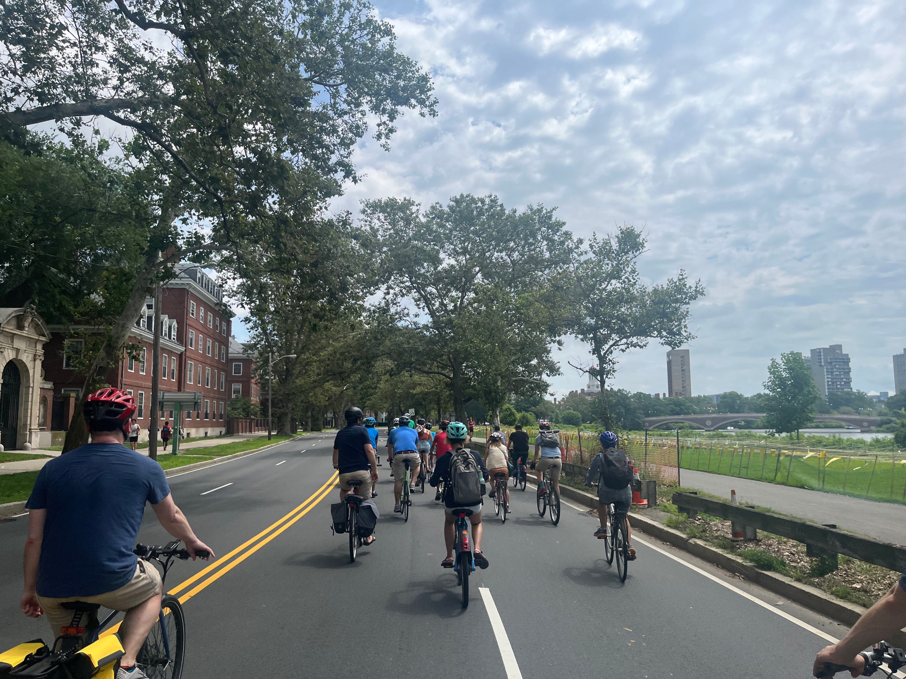
A long-planned project to improve riverfront paths and reduce the width of the Memorial Drive highway in Cambridge from 4 lanes to 2 lanes will get underway next year.
“We plan on advertising for construction this winter, and construction will begin in summer or fall of 2025," said Dan Driscoll, the Director of Green Transportation for the state's Department of Conservation and Recreation, at a virtual public hearing on Thursday evening.
Driscoll later added that the project will take two to three years to complete.
Exhuming the park buried under a highway
Although the Department of Conservation and Recreation (DCR) is ostensibly the state's parks agency, the agency's bureaucratic forebears notoriously bulldozed hundreds of acres of public parkland to build highways during the 20th century.
Today, the DCR's highways rank among the Boston region's most dangerous roads and among its most noxious sources of traffic congestion and air pollution.
But over the past decade or so, the agency has started taking small steps to mitigate that legacy and reduce the impacts of highways in public parks.
The proposed Memorial Drive project will reconstruct a 0.8-mile segment of Memorial Drive and its multi-use pathways between the Eliot Bridge and the Anderson Bridge/John F. Kennedy Street intersection.
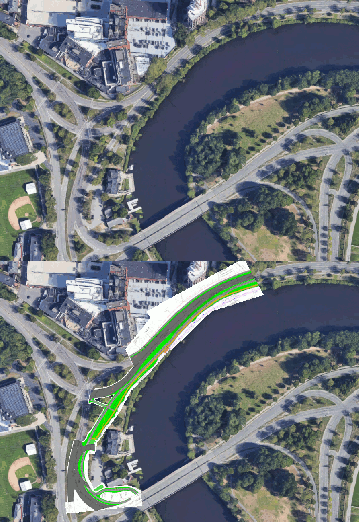
For most of that segment, the DCR will reduce the width of Memorial Drive to convert it from a four-lane highway to a two-lane street.
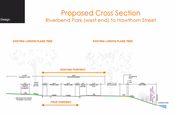
The reduction in the width of the roadway will let DCR create two new riverfront paths: a new 5-foot-wide stone-dust pathway designed for slower pedestrian traffic, and a paved 11-foot-wide path designed to be shared by faster-moving traffic, including bikes, pedestrians, runners, and rollerbladers:
Two short segments at either end of the project area, near the Anderson Bridge and Mt. Auburn Hospital, will transition back to the existing 4-lane cross-section to give more space for drivers to queue at the traffic lights.
The project will also simplify the complex highway interchange where Memorial Drive meets Gerry's Landing Road, near Mt. Auburn Hospital, by eliminating a northbound off-ramp from the Eliot Bridge to Memorial Drive:
Design will replace an acre of polluted asphalt with parkland
The narrower roadway won't just make room for new bike and pedestrian pathways. It will also restore riverfront parkland that had been ceded for decades to suburban motor vehicle traffic.
The DCR's plans will replace roughly one acre of asphalt with greenery. Some of that greenspace will be in new, specialized rain gardens, or "bioswales," which will help absorb the contaminated runoff that washes off the highway towards the Charles River during rainstorms.
Those gardens will "treat stormwater in an environmentally sensitive way, but also an aesthetically appealing way,” said Driscoll.
“We need to find ways to reduce pavement and vehicle emissions near the river, and this is a big step forward to do that,” said Laura Jasinski, executive director of the Charles River Conservancy.
New crosswalks, traffic lights
The project also aims to considerably improve access between the Cambridge riverfront and adjacent neighborhoods west of Harvard Square.
Currently, this stretch of Memorial Drive has only three crosswalks, at the intersections with Gerry's Landing Road, Hawthorn Street, and at JFK Street.
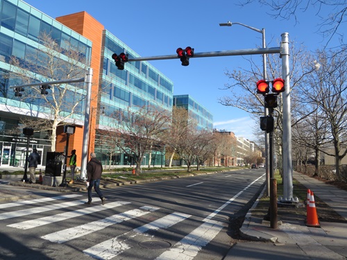
“There’s a ton of jaywalking,” said Driscoll.
As part of their upcoming project, DCR is planning to add crosswalks at Sparks Street and University Road with new "HAWK" signals that will give drivers a red light when pedestrians are crossing.
"Another thing these crossings are going to do is slow down traffic," said Driscoll.
The DCR will also reconfigure the Hawthorn Street intersection to replace a high-speed right turn slip lane with more green space.
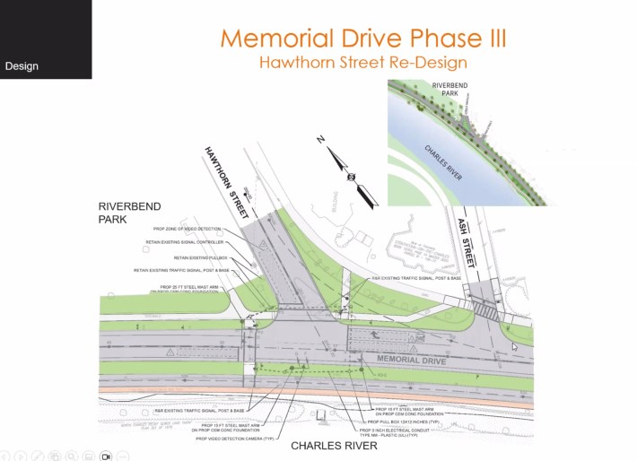
The DCR has posted a recording of Thursday's meeting and a copy of the slide deck presentation on its website.
