Eyes On the Street: Cambridge’s Cycling Safety Ordinance Delivers More Protected Bike Lanes
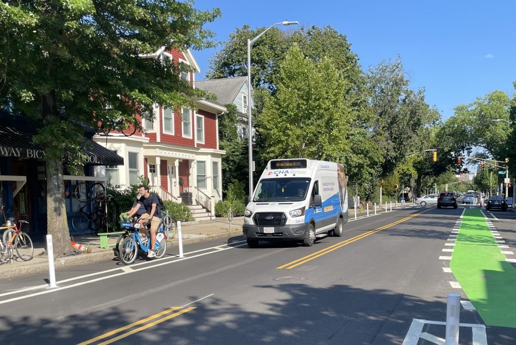
This summer, the City of Cambridge is implementing a major new cross-town bike route that connects Kendall Square to the Harvard campus on Broadway, one of the final protected bike lane projects that the city is required to complete by the end of this year under the 2020 Cycling Safety Ordinance.
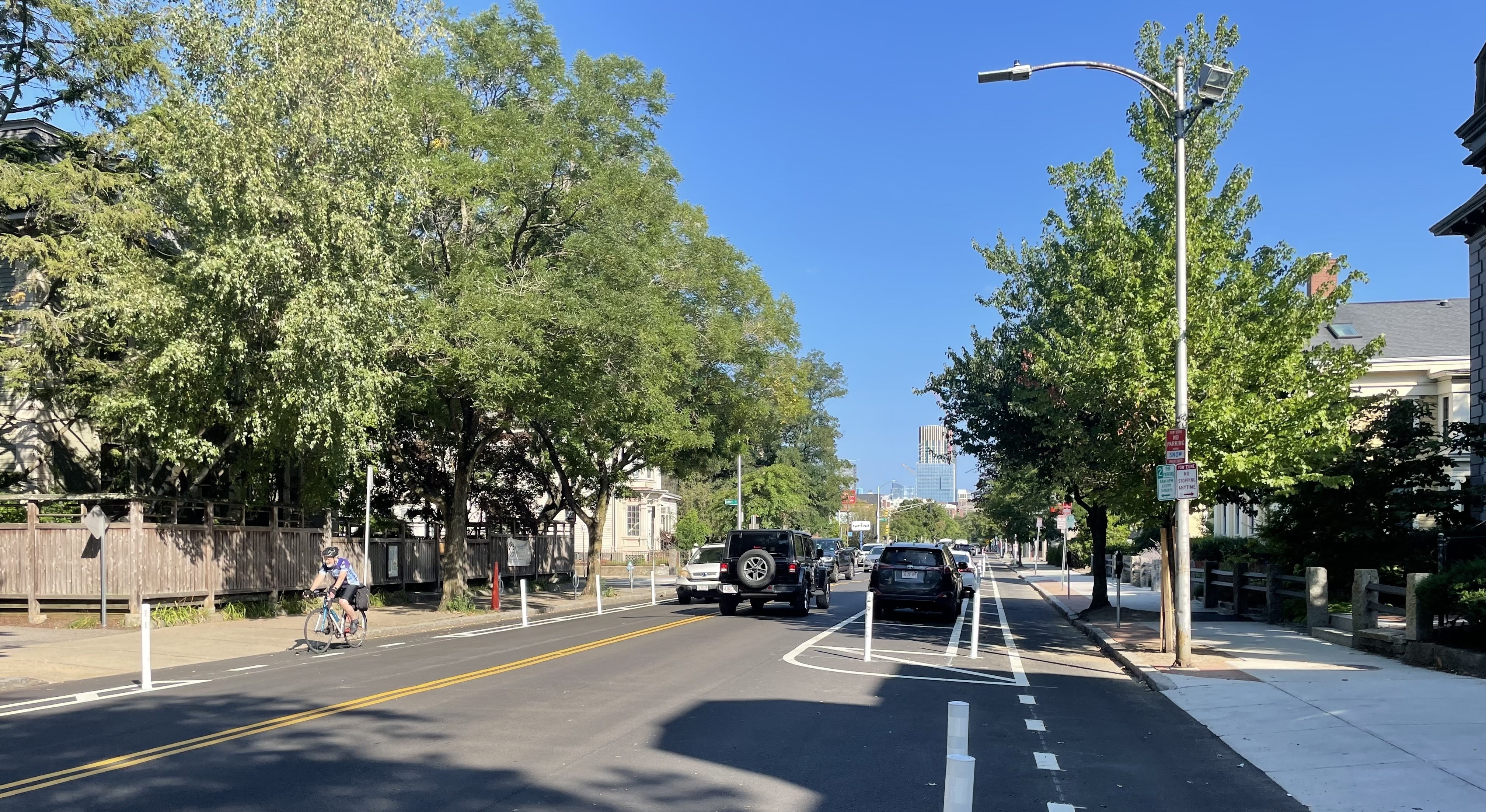
The project connects to existing protected bike lanes on the Longfellow Bridge and in the Harvard Square area to create a continuous protected route from Harvard to Charles Circle in downtown Boston.
The City of Cambridge had previously installed a short segment of protected bike lanes on the eastern part of Broadway, from Columbia Street to the Hampshire Street intersetion, in 2025.
This year, the city is extending those lanes further west in conjunction with a repaving project.
The newly-reconfigured street generally retains a lane of on-street parking on one side of the street, and a bollard-protected bike lane on the other side of the street.
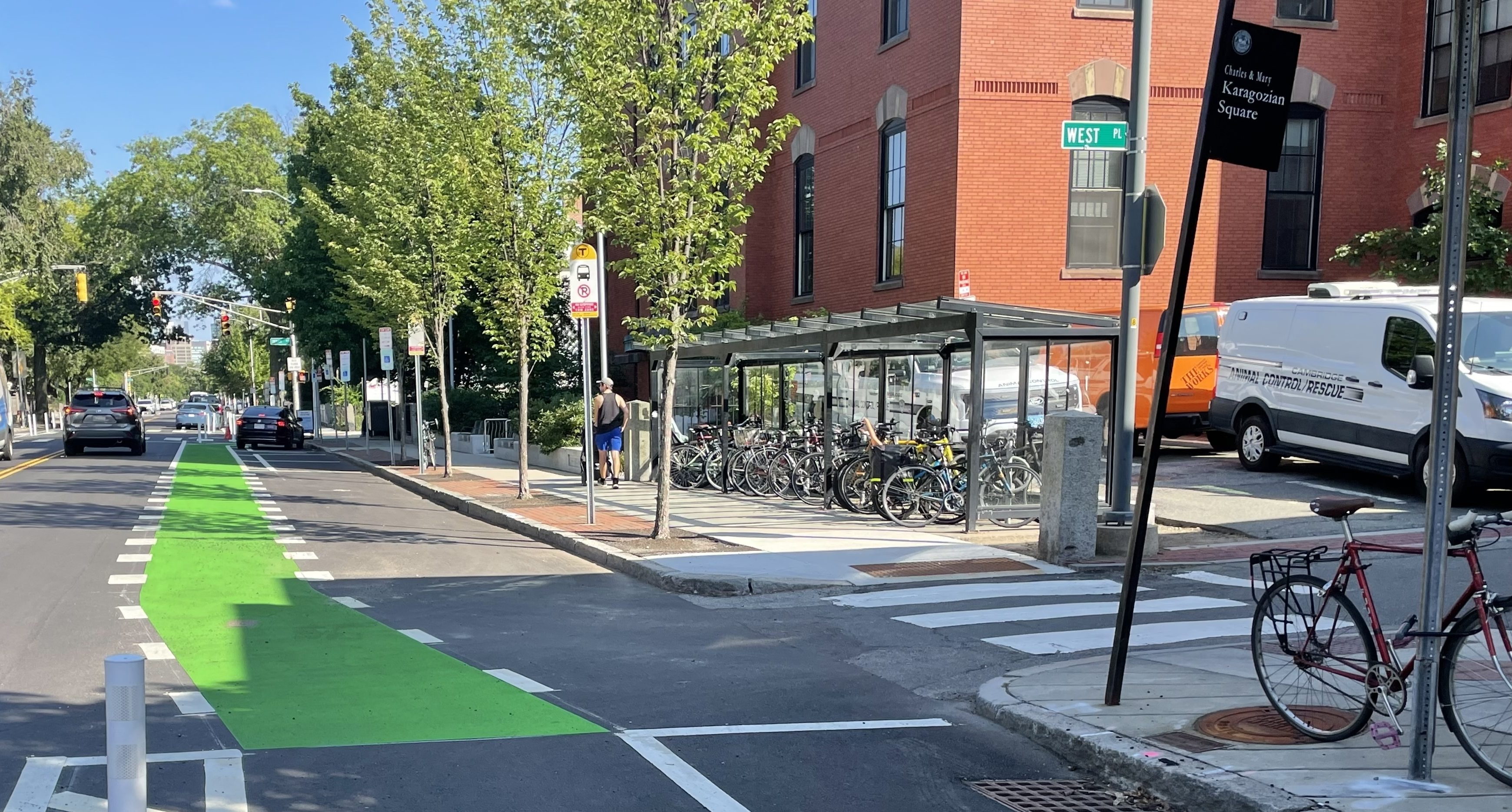
In a handful of locations, the bike lanes jog around bus stops or curbside handicapped parking spaces, like this stretch near City Hall Annex:
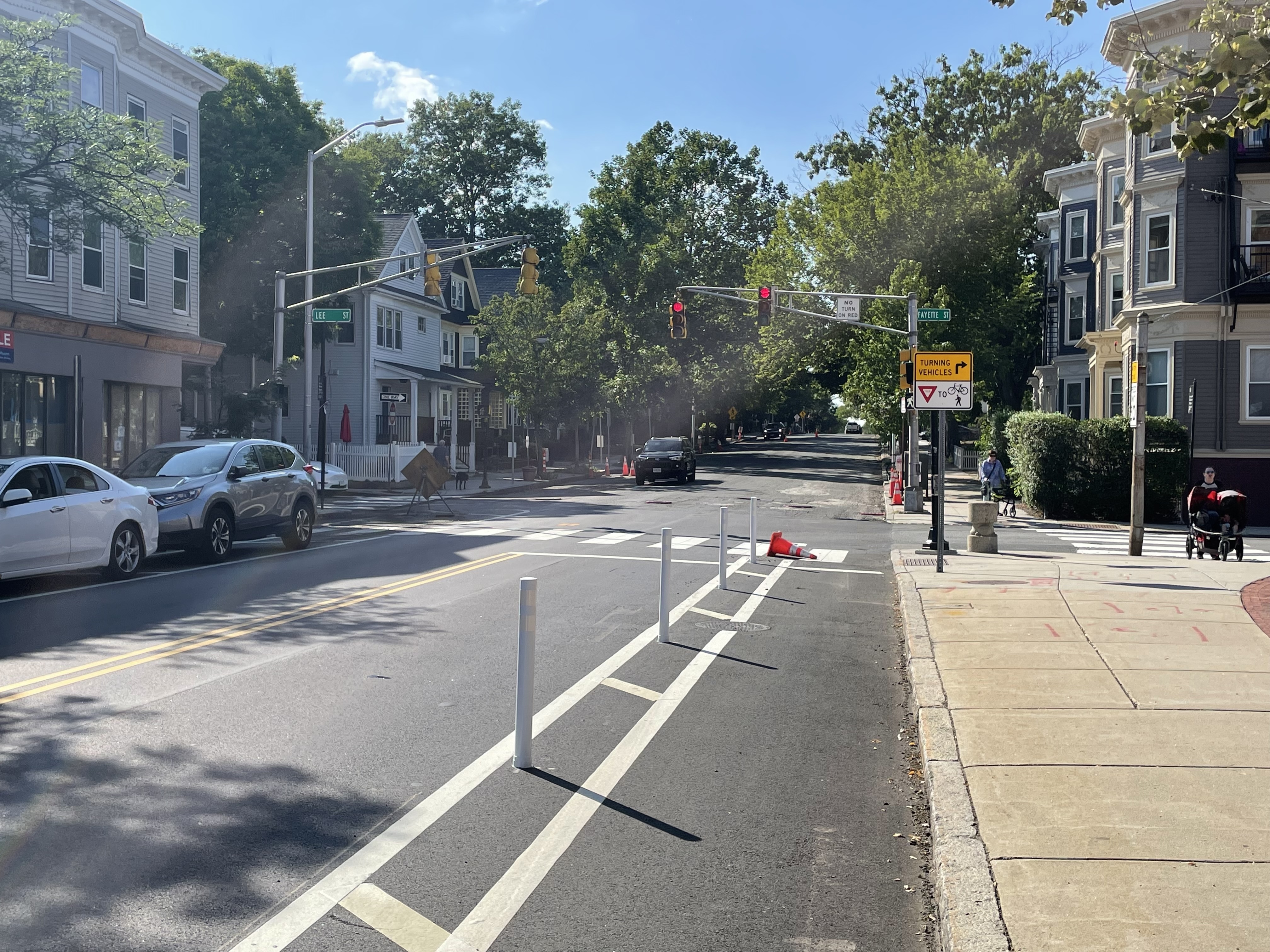
As of last week, the new bikeway had been completed as far as Fayette Street, but the final half-mile to Harvard Square was still being prepped for a fresh coat of asphalt:
River Street project nears completion
A few blocks away, to the west of Central Square, the city is nearing the finish line on a much more substantial street construction project on River Street.
River Street has been under heavy construction since 2022, but when it’s finally complete, it will have a new eastbound sidewalk-level bike lane running from Memorial Drive to Central Square to complement the westbound Western Avenue protected bike lane that Cambridge built in 2016.
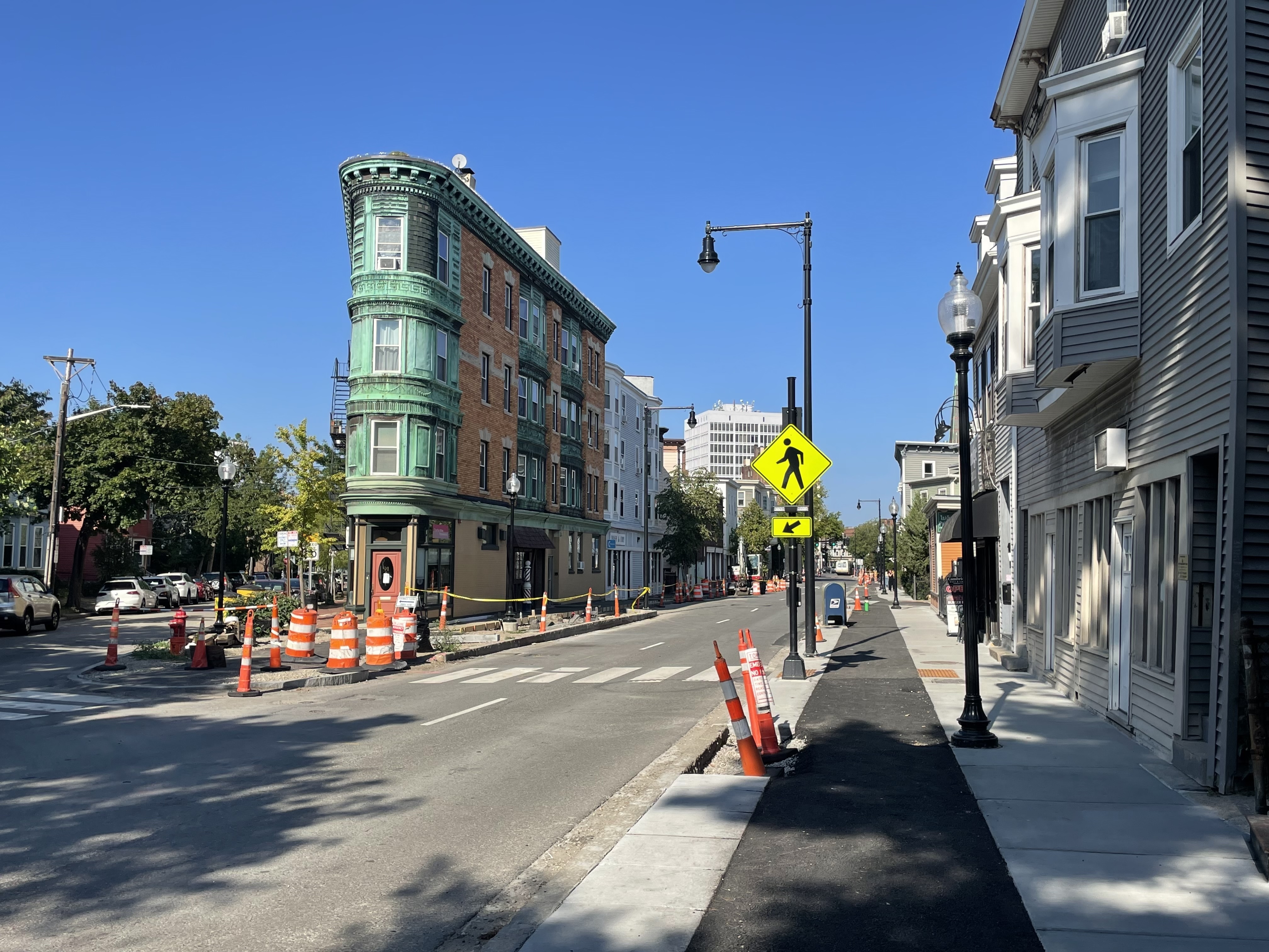
The project is closest to completion on the blocks nearest to Central Square:
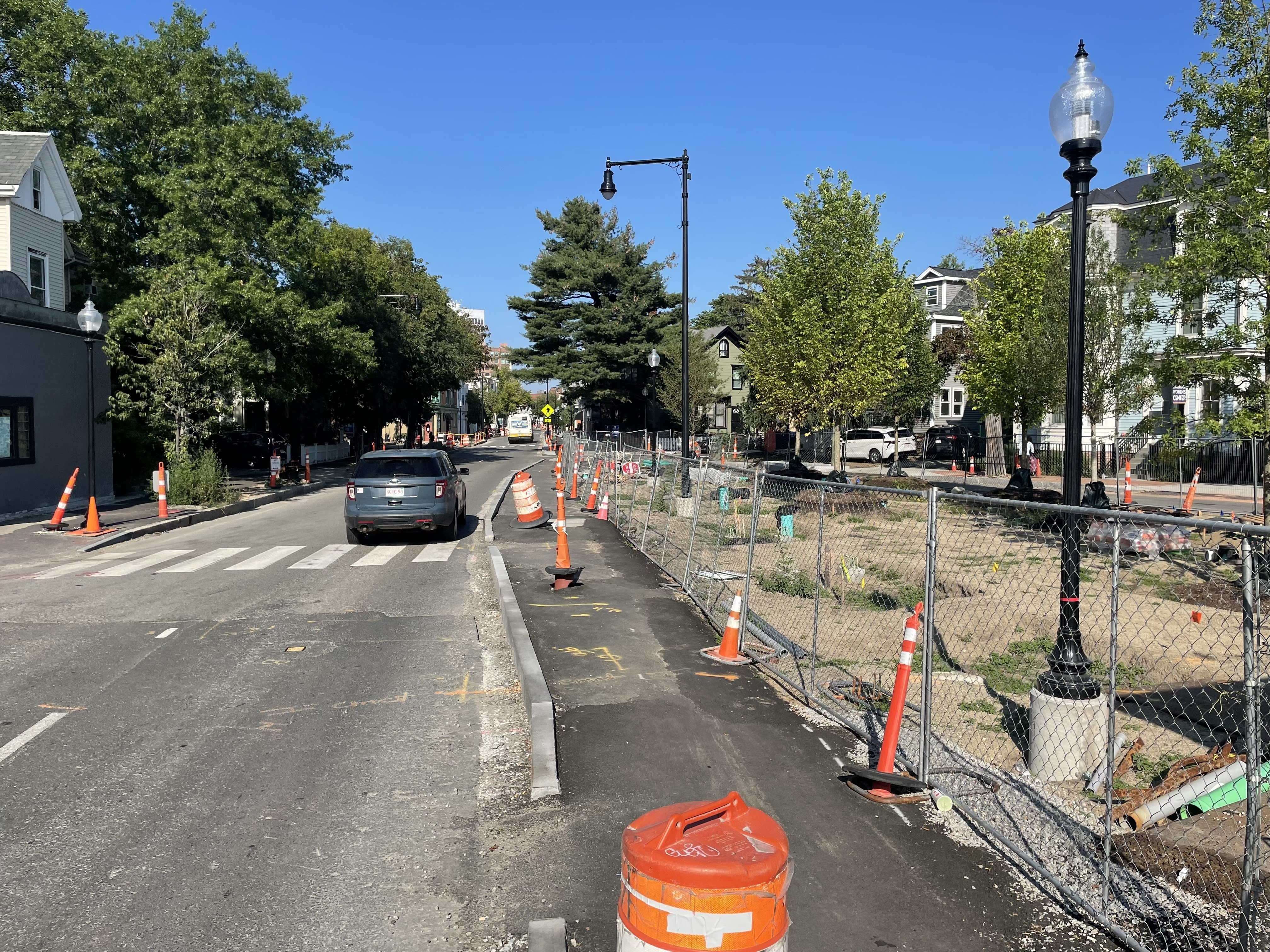
However, as you get closer to the river, the street is still under heavy construction.
Still, some of the details are beginning to emerge. At the corner of Kinniard Street, for instance, you can get a sense of how the project is expanding the triangular Tubman Square park:
Other Cycling Safety Ordinance projects in the works
The Cycling Safety Ordinance also calls for Cambridge to complete protected bike lanes all of Massachusetts Avenue, plus on Cambridge Street from Inman Square to Second Street, by November 2026.
The city is unlikely to meet that deadline, as several of those projects are still in the design phase, but its City Hall is making good-faith efforts to install most of those bikeways within the next year.
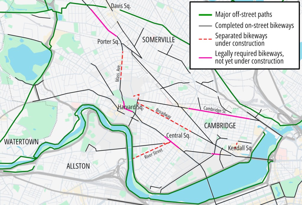
The City of Cambridge’s website says that the city will install separated bike lanes on two segments of Cambridge Street (from Prospect to Willow, and from Fulkerson to Second) before the end of 2026. That will leave a short 6-block gap from Willow to Fulkerson in the vicinity of Donnelly Field, which the city intends to complete in 2027.
On Massachusetts Avenue, the city’s plans and schedule are less certain. Between Porter Square and the Cambridge Common, workers are currently removing the street’s abandoned trolleybus wires and the street’s raised median in anticipation of building new separated bike lanes and a dedicated MBTA bus lane later this year.
But other key segments of Massachusetts Avenue – in Harvard and Central Squares, and north of Porter Square – still have an uncertain timeline for implementation.

Read More:
Streetsblog has migrated to a new comment system. New commenters can register directly in the comments section of any article. Returning commenters: your previous comments and display name have been preserved, but you'll need to reclaim your account by clicking "Forgot your password?" on the sign-in form, entering your email, and following the verification link to set a new password — this is required because passwords could not be carried over during the migration. For questions, contact tips@streetsblog.org.