Eyes On the Street: Medford’s New Clippership Connector
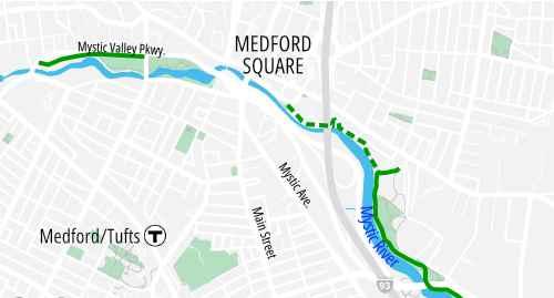
A new link in the network of Mystic River waterfront greenways recently opened in the City of Medford, connecting Medford Square to Riverbend Park to complete a continuous off-street biking and walking path from the Wellington area to Medford Square.
The state’s Department of Conservation and Recreation (DCR) calls the project the “Clippership Connector,” named for downtown Medford’s riverfront Clippership Park at the western end of the new trail.
The project was originally described in the DCR’s 2009 Mystic River Master Plan, and detailed design work for the trail link began in 2017.
While much of the Mystic River’s waterfront is public land, this segment crosses numerous privately-owned parcels that required DCR to negotiate easements and make certain compromises in the trail’s design.
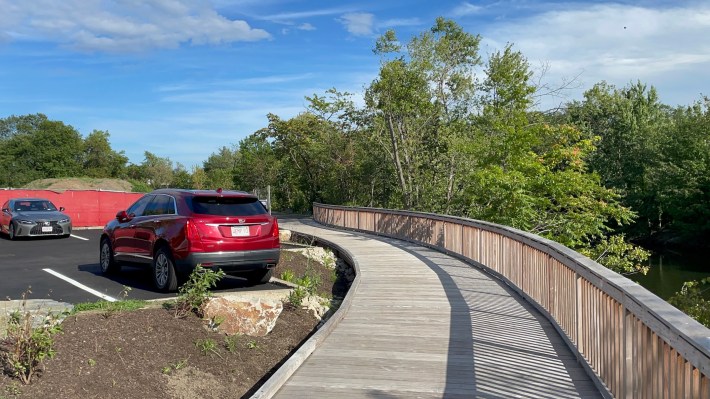
For instance, just east of Medford Square, the trail designers had to suspend the trail on a curved wooden boardwalk to detour around a riverfront parking lot for the Riverside Towers senior housing complex:
Further east, the trail makes another detour to go around the Medford Yacht Club, which occupies part of the riverfront next to Riverbend Park.
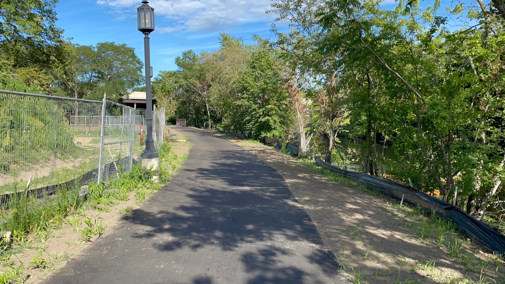
Taken together, these little detours create a trail route that’s considerably less direct than Medford’s Riverside Avenue, which also connects Medford Square to Riverbend Park.
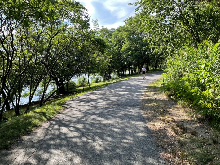
But even though it’s longer, the trail route is also considerably more pleasant than the on-street alternative, with lots of shade and frequent views of the river through the trees along the riverbank.
Half a mile east of Medford Square, the Clippership Connector trail ends in Riverbend Park, where an existing network of paths connects to Medford’s two middle schools and, further east along the river, the DCR’s Torbert Macdonald State Park.
A separate trail project that could begin construction this fall would extend the greenway to the Wellington Orange Line station with a new riverbank boardwalk under the Fellsway Bridge, whose sidewalks and separated bike lanes also connect the greenway to the Assembly district in Somerville and another network of riverfront paths on the southern bank of the river.
Another trail – the South Medford Connector – is being planned for the southern bank of the Mystic from Medford Square to the Route 16 bridge (also known as the Veterans Memorial Highway or Mystic Valley Parkway bridge) in South Medford.
That project is tentatively scheduled for construction in 2027, according to MassDOT’s project database.
Our nonprofit journalism relies on readers like you. Support StreetsblogMASS year-round by setting up a monthly contribution:

Read More:
Streetsblog has migrated to a new comment system. New commenters can register directly in the comments section of any article. Returning commenters: your previous comments and display name have been preserved, but you'll need to reclaim your account by clicking "Forgot your password?" on the sign-in form, entering your email, and following the verification link to set a new password — this is required because passwords could not be carried over during the migration. For questions, contact tips@streetsblog.org.