Skip to Content
Streetsblog Massachusetts home
Log In
StreetsblogMASS

2020 In Review: The Year’s Top 10 Stories

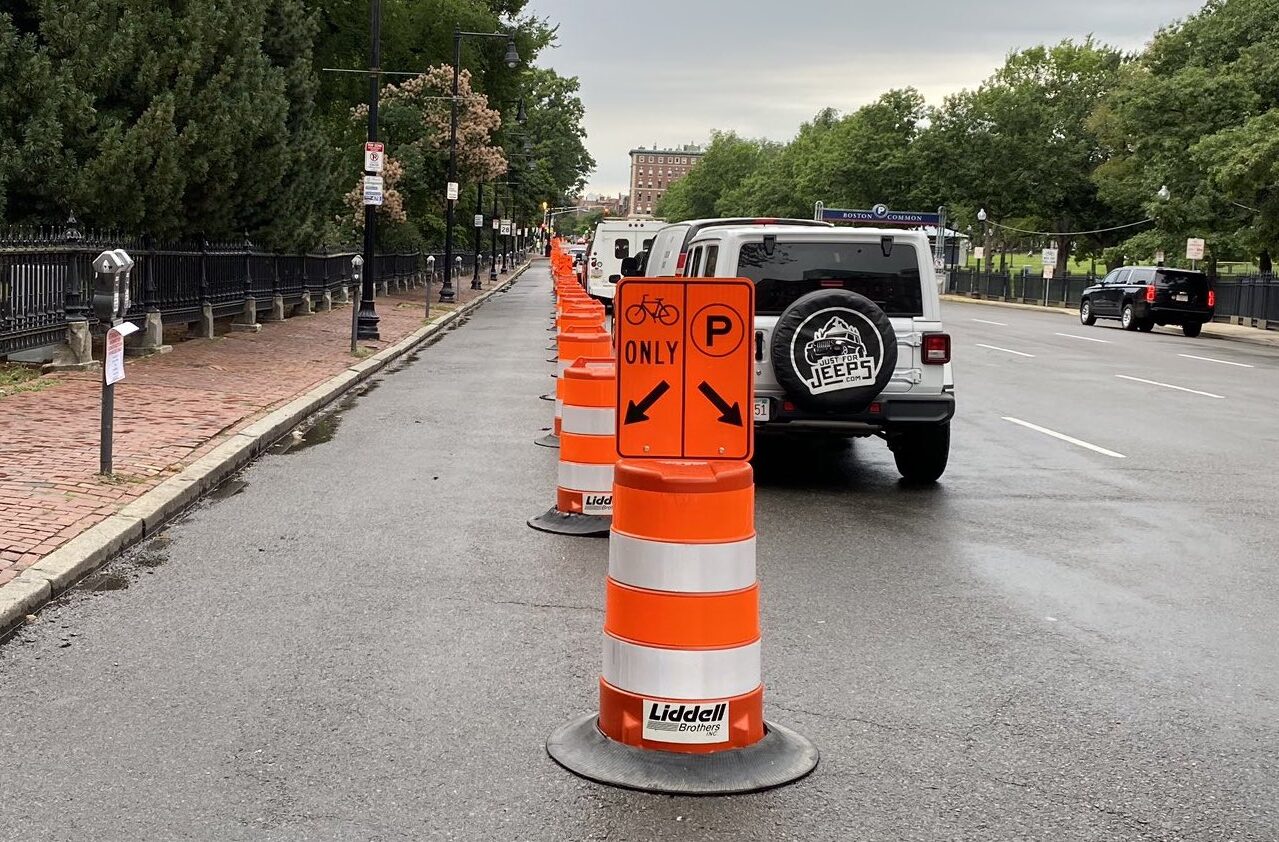
A new protected bike lane, photographed here on the morning of Wednesday, July 22, was installed using temporary materials on Charles Street in downtown Boston as part of the city’s “Healthy Streets” initiative. Photo courtesy of StreetsblogMASS board member Matt Lawlor.

StreetsblogMASS relies on the generous support of readers like you. Help us meet our year-end fundraising goals – give today!

2020 was a year of high-stakes news stories. In the face of multiple crises, the political urgency of transforming the Commonwealth's transportation systems faded like traffic jams during a lockdown.

But a look at our top stories from the past year reveals how our streets – both as public spaces, and as embodiments of our politics – continued to transform and adapt during the many upheavals of 2020. Advocates worked hard this year to envision healthier, fairer, and safer cities for the future, and while there's a lot of work left to be done, there are also a lot of accomplishments to celebrate.

Thanks for reading StreetsblogMASS this year – we'll be back in 2021.

#1: Massachusetts Will Join Conn., R.I. and D.C. in New Transport Cap-and-Trade Program

Our most-read story for 2020 was one that was published just last week, on Dec. 21, thanks to a large surge of traffic from Google News algorithms. The new cap-and-trade program won't come into force until 2023, so the story has a chance to appear in two more of these year-in-review roundups in the meantime.

#2: DCR Starts Shutting Cars Out of Park Roads to Reduce COVID-19 Risk
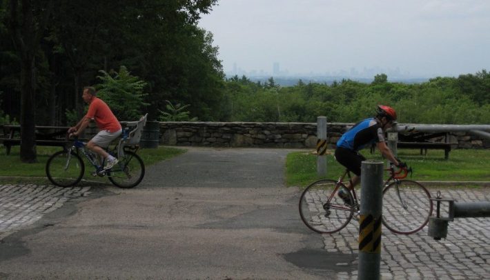
Chickatawbut Road in the Blue Hills Reservation, pictured in summer 2012. Photo courtesy of Lee Toma/Bike Milton.

This story, from April 5, outlines how the state Department of Recreation (DCR) closed suburban park roadways in an effort to manage crowds and provide more space for outdoor recreation in the early days of the pandemic. The article was shared widely on social media, but with the exception of Memorial Drive in Cambridge, the program never expanded to more urban streets under the DCR's jurisdiction.

#3: Two Dead In Aftermath of Highway Contractor’s Holiday Party
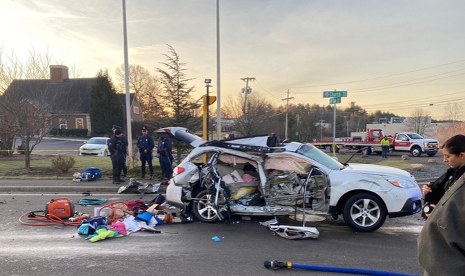
Courtesy of the Pembroke Firefighters Local 2351.

Published on January 2nd. According to a May 14 report from the Quincy Patriot-Ledger, Hi-Way Safety Systems has been reinstated as a pre-qualified bidder for MassDOT projects after Kenneth Horn, the host of the deadly New Year party, relinquished his role as a company owner. Horn is unlikely to suffer many material consequences from the changes: his successor, Kathy DeLong, is also his wife.

#4: An Updated Rough Guide To Boston’s Allston/I-90 Megaproject
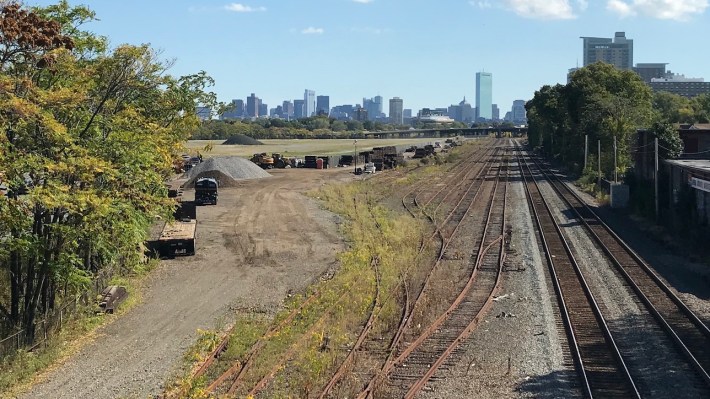
The site of the future West Station, seen from the Cambridge Street overpass in Allston. A realignment of the Massachusetts Turnpike through this area is poised to touch off a massive urban development scheme on the vacant Harvard-owned lands visible in the distance.
The site of the future West Station, seen from the Cambridge Street overpass in Allston. A realignment of the Massachusetts Turnpike through this area could touch off a massive urban development scheme on the vacant Harvard-owned lands visible in the distance – but only if someone is willing to pay for it.

Originally published in October 19, 2019, and updated several times in 2020. MassDOT is expected to make a decision on the project's conceptual design early in the new year – and when they do, we'll update this article again.

#5: Green Line Amputation: T Cuts Would Mothball Light Rail in Mission Hill
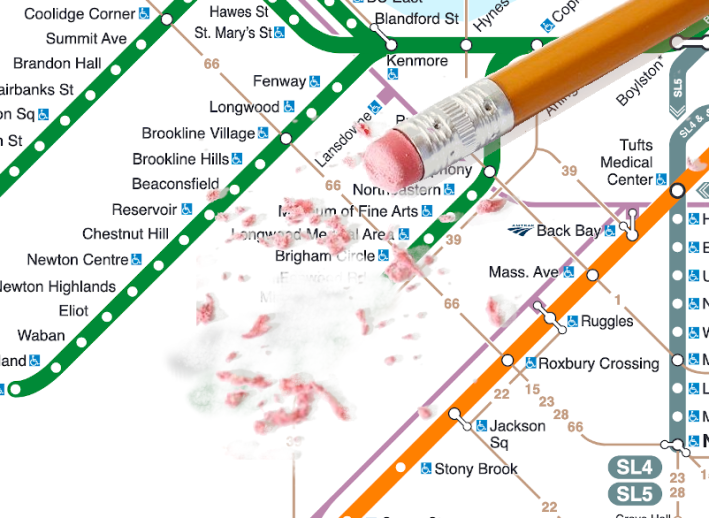
The MBTA's proposed service cuts for 2021 would eliminate five stops at the end of the Green Line's E Branch in Boston's Mission Hill neighborhood.
The MBTA's initial proposal for service cuts in 2021 would have eliminated five stops at the end of the Green Line's E Branch in Boston's Mission Hill neighborhood.
The MBTA's proposed service cuts for 2021 would eliminate five stops at the end of the Green Line's E Branch in Boston's Mission Hill neighborhood.

Published on Dec. 2. The MBTA's proposed service cuts were the subject of many stories this fall and winter, but this article – about the T's proposal to end light rail service just weeks after finishing an $18 million project to refurbish tracks on the same branch – was a reader favorite.

#6: TransitMatters Issues Detailed Game Plan for Regional Rail Upgrades
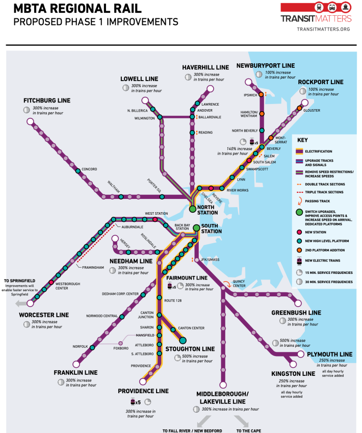
Advocates say that these upgrades to the commuter rail network would allow trains to run every 15 to 30 minutes on most lines. Courtesy of TransitMatters.

Published on June 22. Amidst budget cuts, the "Rail Vision" projects that were intended to usher in frequent, all-day service on the T's commuter rail system have been put on a back burner, but TransitMatters has published several detailed reports this year to help jump-start the initiative as soon as policymakers put up the money.

#7: Boston Pitches Major Transit-Focused Redesign For Blue Hill Ave.
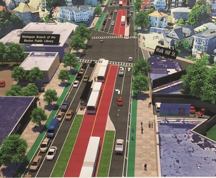
A City of Boston rendering illustrates the center-running bus lane concept for Blue Hill Avenue near Walk Hill Street. Under the plan, bus lanes and dedicated stations would run in the middle of the street, away from double-parked cars and turning vehicles. Pedestrian crossings would also be significantly shorter. Courtesy of the City of Boston.
A City of Boston rendering from 2020 illustrates the city's concept for center-running bus lanes on Blue Hill Avenue near Walk Hill Street. Under the plan, bus lanes and dedicated stations would run in the middle of the street, away from double-parked cars and turning vehicles. Pedestrian crossings would also be significantly shorter. Courtesy of the City of Boston.

Published on March 3. I didn't know it at the time, but this was the last in-person public meeting I attended this year. And it was a good one: many attendees were genuinely excited to see the City of Boston proposing a major public investment to benefit bus riders in their neighborhood. The project failed to win a competitive federal grant earlier this year, but the city and the T are expected to pursue alternative sources of financing in 2021.

#8: Driver Kills Bicyclist on Mass. Ave. in South End
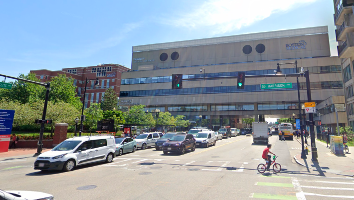
Massachusetts Avenue passes under the Boston Medical Center near Harrison Street in this 2019 Google Street View image. The City of Boston is planning a capital project that would provide a protected bikeway on this section of Mass. Ave., between Harrison Ave. and Melnea Cass Blvd.
Massachusetts Avenue passes under the Boston Medical Center south of Harrison Street in this 2019 Google Street View image. The two-block segment of Mass. Ave. between Harrison Street and Melnea Cass Boulevard is the deadliest section of roadway in the City of Boston.

Published on April 22. In two separate incidents, drivers killed two victims on Massachusetts Avenue outside the Boston Medical Center during the lockdown this spring. The city responded by installing a robust, curb-protected bike lane there in November – but after more reckless drivers crashed into the new curbs, the city removed them, leaving more hospital visitors and staff vulnerable on one of Boston's most dangerous streets.

#9: Mayor Walsh Announces Details of New ‘Healthy Streets’ Initiative
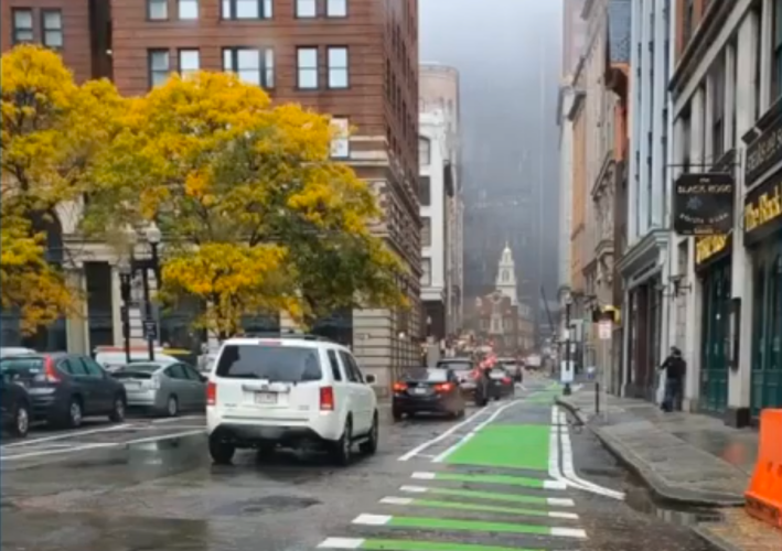
A quick-build protected bike lane on State Street in downtown Boston, pictured in October 2020. Courtesy of the City of Boston.

Published on May 28. Boston's new downtown bike lanes – delineated this summer with construction barrels, which were later replaced with flexible bollards – earned national attention this year, and were recently named by the advocacy group People for Bikes as one of the nation's best new bikeways of 2020.

#10: Everett, Somerville Advance Silver Line Extension Project
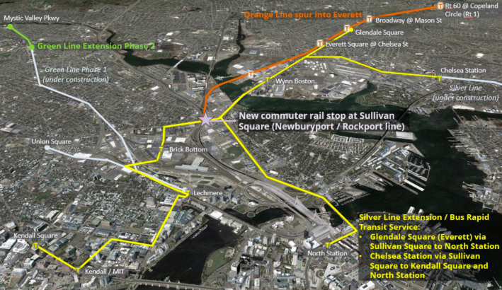
Transit improvements analyzed in the Lower Mystic Regional Working Group's 2019 transportation study, which recommended two extensions (highlighted in yellow) of the Silver Line from its current terminus in Chelsea. Courtesy of the Lower Mystic Regional Working Group.

Published on February 13. Somerville and Everett both helped their bus riders this year with quick-build bus lanes in places like Union Square and Sweetser Circle. But the cities are also contemplating a more continuous transitway that would connect Chelsea, Everett, East Somerville, and Kendall Square. This will be another story we expect to follow in 2021 and beyond.
Stay in touch

Sign up for our free newsletter