What’s Changed, And What Hasn’t, In Boston’s New Blue Hill Avenue Busway Plan
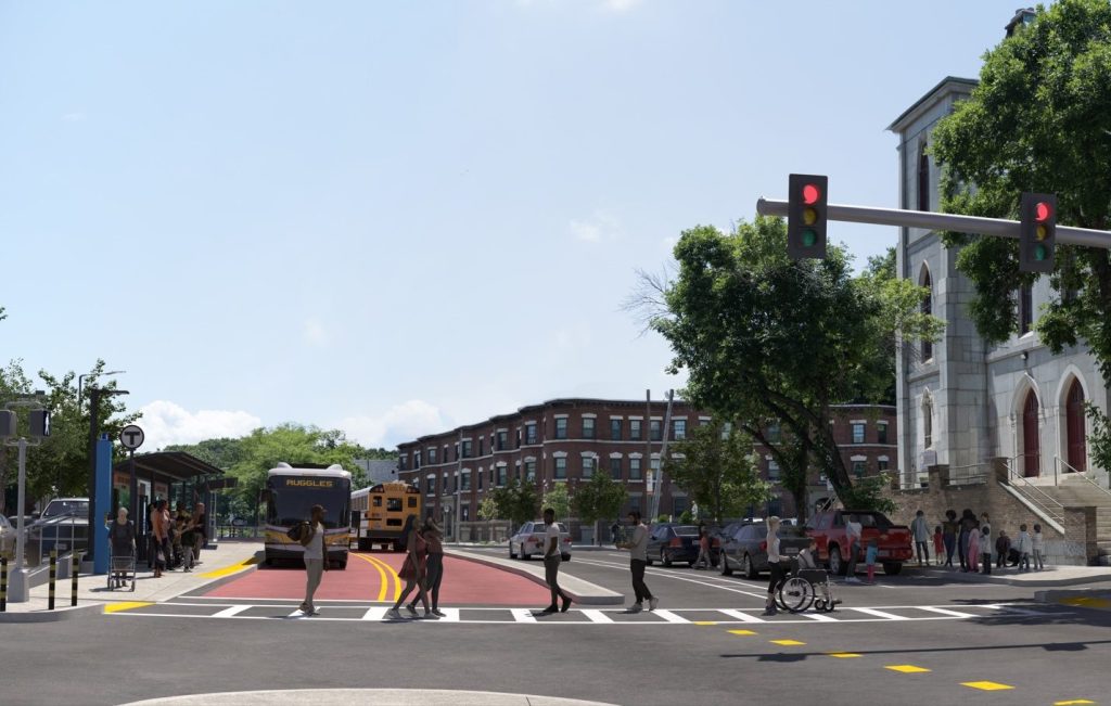
Late last week, the City of Boston and the MBTA released yet another revised design for the Blue Hill Avenue busway project, which aims to speed up buses on frequent-service routes like the 28 and 22 with a dedicated center-running busway with new stations and amenities for riders.
The MBTA estimates that a dedicated busway on Blue Hill Avenue could cut 10 to 15 minutes off a typical rush-hour bus trip between Grove Hall and Mattapan Square, and benefit some of New England’s most crowded bus routes.
Earlier this year, Congress earmarked $80 million to finance the busway’s construction, , contingent on the inclusion of “a continuous, bi-directional, center-running bus priority facility.” Governor Healey’s administration has pledged an additional $51 million in state and MBTA funding.
But while the project is gaining momentum, and has overwhelming support across the city as a whole, it’s been more polarizing in Mattapan and Roxbury, where a contingent of politically well-connected individuals have been lobbying the Trump administration to cancel the project.
Earlier this summer, the Wu administration announced new tweaks to the project’s design that were clearly aimed at placating those critics, emphasizing that the new project “has more parking than what’s available today,” and more lanes for private vehicle drivers.
The MBTA released a detailed plan of the updated design last week. We compared those plans to the previous design from 2024 to give readers an idea of what’s changed, and what hasn’t, in advance of a new round of public hearings that will kick off with a “town hall” event this Thursday evening at Morning Star Baptist Church.
The center-running busway hasn’t changed
The project’s most prominent element: a two-way, protected, center-running busway to keep MBTA buses out of traffic, hasn’t changed much between the 2024 and 2026 iterations of the project’s design.
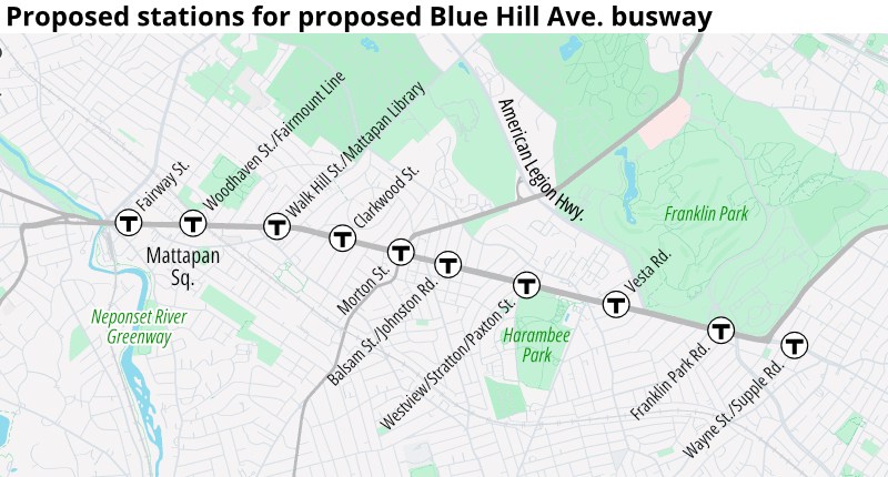
There have, however, been some adjustments to some of the stations’ designs, some of which offer improved connections for transit users and pedestrians.
The images below show how the city’s plans have evolved for the station between Westview and Paxton Streets, at the southwestern corner of Harambee Park:
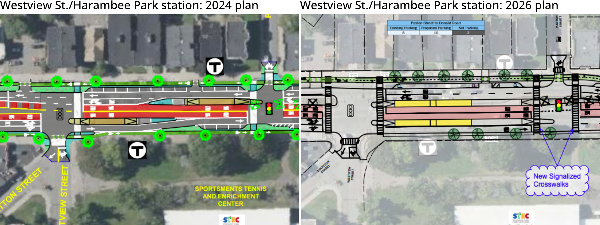
Note how the updated plan (the right image) features longer bus platforms and two additional crosswalks. Those longer bus platforms will also function as median refuges for pedestrians crossing the street at Paxton and Westview.
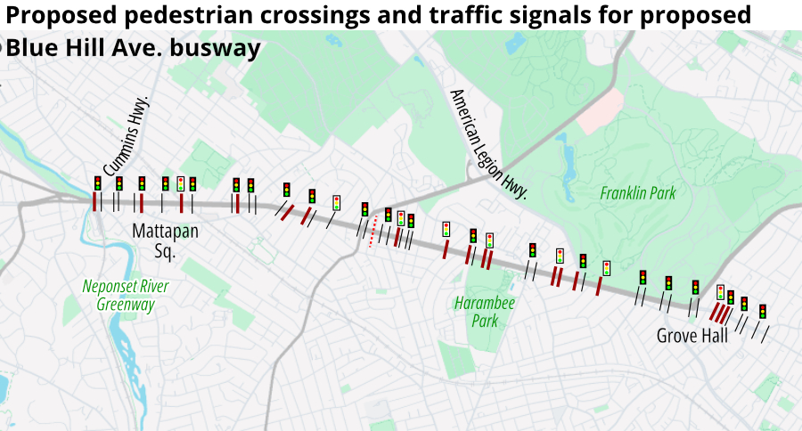
Because these new transit stations will be located in the center of the street, the project also includes robust crosswalk improvements, including more than a dozen new crosswalk locations.
The project would install several new traffic signals that will stop traffic for pedestrians to cross Blue Hill Avenue.
Less space for bikes, more space for cars
The biggest changes in the city’s latest design involve the street’s planned bike infrastructure, which has been reduced in size in order to provide more land for taxpayer-subsidized parking and motor vehicle lanes.
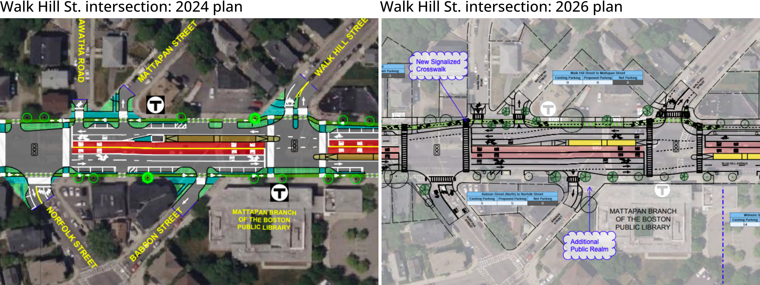
At the intersection of Blue Hill Avenue and Walk Hill Street, for instance, the 2024 plan called for three to four general-purpose travel lanes between Walk Hill Street and Norfolk Street, in front of the neighborhood library. In the new plan, there would be five lanes:
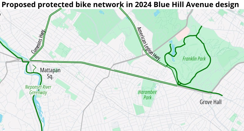
The 2024 design would have created a near-continuous pair of protected bike lanes along Blue Hill Avenue to connect Franklin Park to the Neponset River Greenway (albeit with a short gaps to accommodate parking near Morton Street and in Mattapan Square):
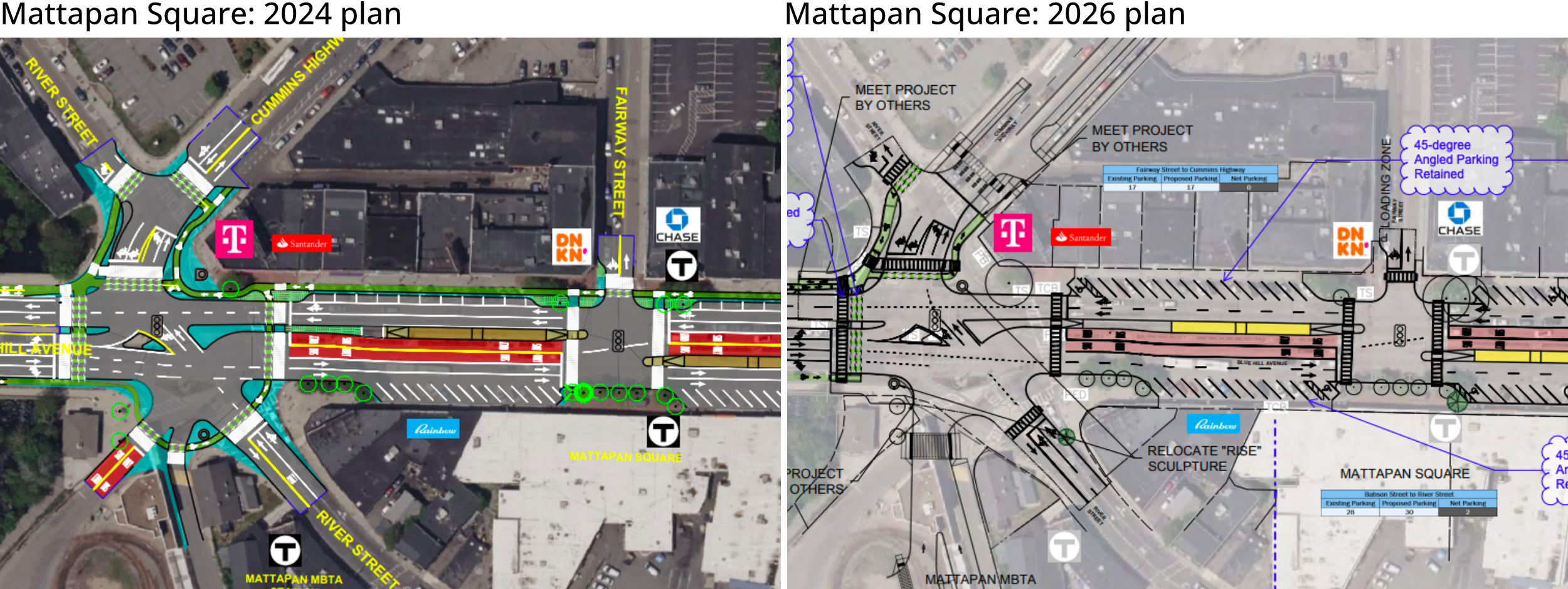
In the new plans, there would be no bike infrastructure on Blue Hill Avenue on a 0.4-mile segment of the Avenue through Mattapan Square, in order to provide additional space for angled curbside parking.
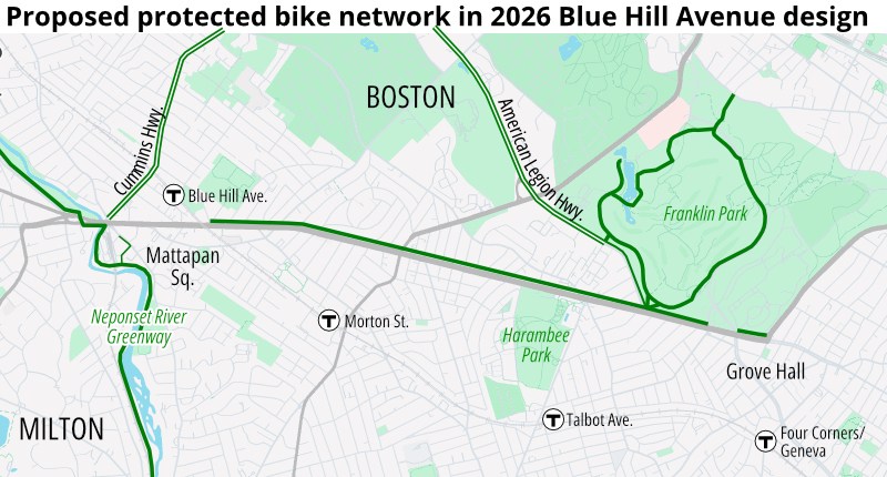
A comparison of the 2024 and 2026 plans suggests that these gaps in the protected bike network have been designed to accommodate more on-street parking in Mattapan Square and Grove Hall.
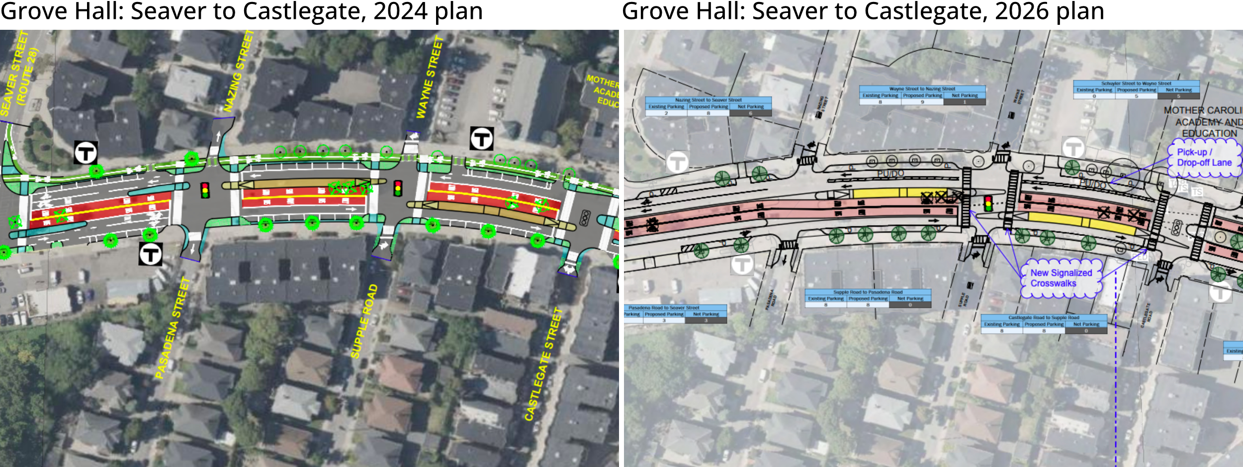
In the Grove Hall neighborhood, just north of Seaver Street, the previous 2024 plan called for a two-way protected bike path on the west side of the street to connect the neighborhood to Franklin Park.
In the new plan, the space that had been previously allocated for a bike path would instead become an extra southbound lane with sanctioned double-parking at certain hours to accommodate pickups and dropoffs at the Mother Caroline Academy school:
Similar trade-offs are also evident in the updated plans for Mattapan Square. In the 2024 plans, there would have been a nearly-continuous southbound protected bikeway to connect from Grove Hall to the Cummins Highway and Neponset River bike paths (the northbound bike lane would have begun near Babson Street, leaving a short gap for northbound riders through the heart of the square):
There is one location where the updated design provides better facilities for bicycle users than the 2024 design. That’s near Morton Street intersection, where the previous design (below at left) would have interrupted the southbound protected bike lane in order to prioritize an on-street parking lot for cops:
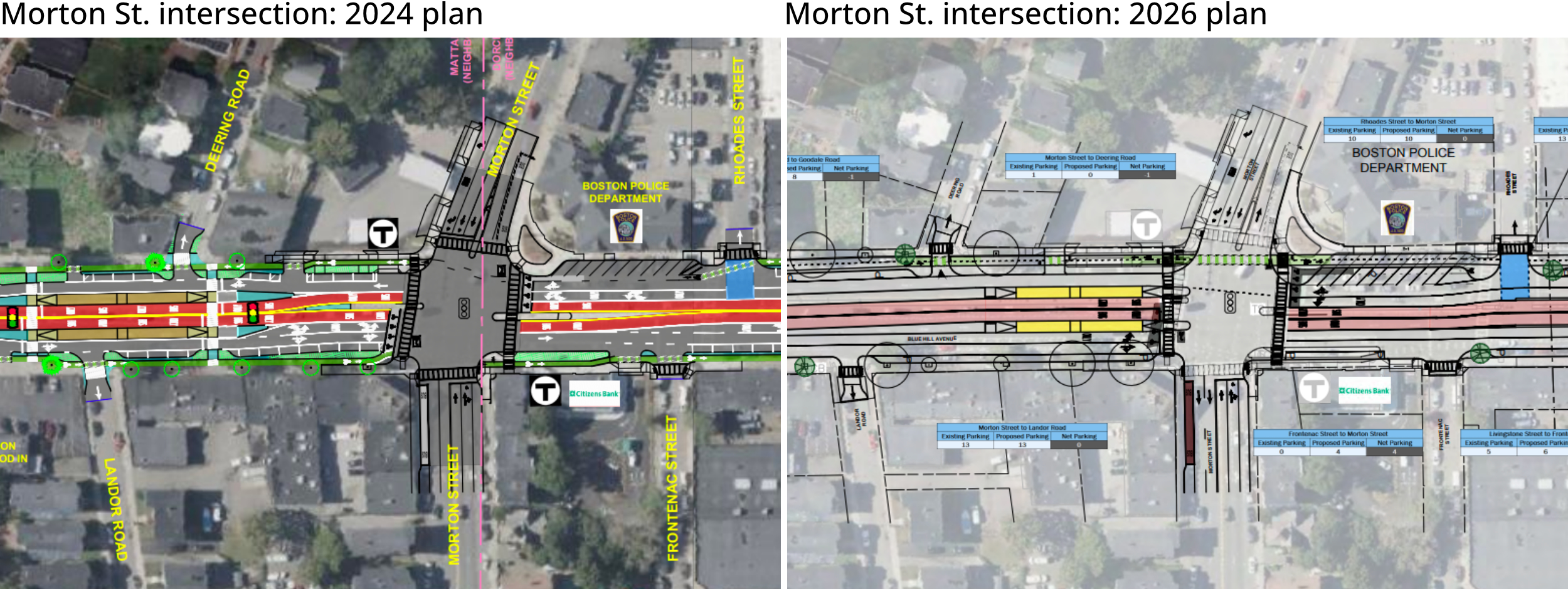
Under the updated plan (right image), the new two-way protected cycletrack would run continuously past the police station between the sidewalk and the on-street parking area.
This September, the City of Boston and MBTA are hosting yet another round of evening in-person meetings for the project’s latest design.
- Thursday, September 10, 6:30 p.m.
Morning Star Baptist Church at 1257 Blue Hill Ave. - Monday, September 14, 6:30 p.m.
BCYF Perkins Community Center, at 155 Talbot Ave. - Tuesday, September 22, 6 p.m.
Mattapan Branch Library, at 1350 Blue Hill Ave. - Wednesday, September 30, 6:30 p.m.
Albert D. Holland School of Technology, at 60 Washington St.

Read More:
Streetsblog has migrated to a new comment system. New commenters can register directly in the comments section of any article. Returning commenters: your previous comments and display name have been preserved, but you'll need to reclaim your account by clicking "Forgot your password?" on the sign-in form, entering your email, and following the verification link to set a new password — this is required because passwords could not be carried over during the migration. For questions, contact tips@streetsblog.org.